Four-lane Highway 30 finally connects Ames, Cedar Rapids by Jeff Morrison

Four-lane Highway 30 finally connects Ames, Cedar Rapids by Jeff Morrison

Hwy 30 road construction photo by Jeff Morrison

A vehicle passes a construction crew picking up traffic cones on eastbound U.S. Highway 30 near the Iowa Highway 21 exit north of Belle Plaine, Iowa, Tuesday, October 15, 2024. The segment of U.S. 30 between Iowa 21 and County Road V44 was the last in a nearly 150-mile-long span to open to four lanes. Photo by author.

Now that Thanksgiving, the traditional end to Iowa’s construction season, is here and gone, it’s time to reflect on a big highway milestone that passed with zero fanfare. In fact, its exact date could have gone unknown had the author not been driving to Des Moines at the right moment.

On Oct. 15, the final restrictions were lifted on U.S. Highway 30 in western Benton County. A 142-mile-long segment between Ogden and Lisbon is now an uninterrupted four-lane road. It’s been a long, long time coming — six decades, as a matter of fact.

Let’s switch off the lights and show an educational filmstrip.

The 16-minute movie from the Iowa State Highway Commission in 1960 was a key component in the state’s public relations strategy for a critical section of U.S. 30. From Ogden east to Iowa Highway 330, the rural highway had not been changed since original 18-foot-wide paving in the Lincoln Highway days. A concrete railroad overpass just east of Nevada dated back to 1923. (It would not be replaced until 1973. A narrow underpass a couple hundred yards away remains to this day.) While we now can appreciate the wide array of car makes and colors in the film, the volume of traffic was an important visual aid to pushing for an all-new road that skirted Ogden, Boone, Ames, Nevada, Colo, and State Center. At the time, the proposed relocation was mostly two lanes.

The campaign worked. By the end of 1964, an all-new road existed along the 55-mile corridor except, ironically, for the highest-traveled segment: Lincoln Way through most of Ames. This segment got bogged down in an argument among the Highway Commission, the city, and Iowa State University on whether, and where, to build an exit south of the university. At one point the plan for the U.S. 30 freeway did not include the single most important entry/exit point for Iowa State events. Although by 1966 the kernel of the idea of the Iowa State Center had been planted, Elwood Drive was “presently a gravel road” (Ames Tribune), Hilton Coliseum would not open for another five years, and the football stadium for another four years after that.

Hwy 30 Ogden to Lisbon
Iowa Highway Ends/Between Two Rivers

The Ames bypass would not be finished until nearly a decade after the rest of the new road had opened — fall 1972. Wrapping up the connection on the west end was prolonged after weather delays including the blizzard of April 8-10, 1973.

Through the turn of the century, only about a third of the 100 miles between I-35 and I-380 were upgraded, mostly south and west of Cedar Rapids.

A photograph of a page from a May 1968 plan shows a proposed four-lane U.S. Highway 30 in Benton County

A photograph of a page from a May 1968 plan shows a proposed four-lane U.S. Highway 30 in Benton County that, in the eastern half of the county, would have dipped half a mile south of the existing road. When U.S. 30 was upgraded to four lanes east of the U.S. Highway 218 junction in 1992 and 1999, it followed the existing road instead. To the west, in the segments that opened in 2024, the four-lane is just a few hundred feet south of the original.

The Highway Commission laid out a comprehensive plan in 1968 envisioning a full statewide network of freeways and expressways — and then the 1970s happened. A substantial percentage of the 1968 network would not be built until between 1994 and 2008 — and then the Great Recession happened.

Midway through that latter time span, a projected funding shortfall put U.S. 30 on the back burner. Other long-awaited corridors received priority instead.

If the state’s plan from 1999 had been carried out, the gap from Marshalltown to U.S. 218 would have been closed by 2005 and finished in eastern Linn County shortly thereafter. Instead, it took until 2024.

A very small ribbon-cutting ceremony was held for the U.S. Highway 30 Tama-Toledo bypass at the west end of that bypass August 13, 2011, in Toledo, Iowa. The four-lane road is the fourth alignment of the highway here since 1926. Photo by author.

A very small ribbon-cutting ceremony was held for the U.S. Highway 30 Tama-Toledo bypass at the west end of that bypass August 13, 2011, in Toledo, Iowa. The four-lane road is the fourth alignment of the highway here since 1926. Photo by author.

It’s been more than 10 years in coming, but the Iowa Department of Transportation has marked the beginning of the Highway 30 Mount Vernon/Lisbon bypass project. … Many project specifics — such as cost and the exact bypass route — won’t be determined for some time. Construction is at least five years away.
— Cedar Rapids Gazette, Aug. 27, 1999

The U.S. 30 bypass of Mount Vernon/Lisbon from west of Wilcox Road in Linn County to Charles Avenue in Cedar County will be open to traffic late Friday afternoon, Nov. 22, weather permitting … .
— Iowa DOT press release, Nov. 18, 2019

The "Bohemian Alps" of Iowa near Tama and Belle Plaine

Tama County’s “Bohemian Alps” before 4-land Hwy 30.  Photo by Prairie Rivers of Iowa

The final section had to cut through Tama County’s Bohemian Alps. These rolling hills are why the Lincoln Highway originally dipped southward to Belle Plaine. It made for a scenic drive whenever you weren’t trailing a semi, but that wasn’t often.

This segment of U.S. 30 has a relative rarity for Iowa travelers: 45 miles and no gas stations (or restrooms). The route had once been peppered with them, including the historic Youngville station, which was at risk of being demolished in the 1990s but has been preserved. Cedar Rapids Gazette columnist Dave Rasdal wrote about the lack of stops in 1994. The gas station at the Luzerne corner (County Road V44) closed a few years after a manager was shot and killed there. Today, for a fill-up visible from the highway, there’s nothing between Toledo and southwest Cedar Rapids. 

Youngville Station Before photo
Youngeville Station after restoration

Youngville Station when the Lincoln Highway/Highway 30 was the main east-west route across Iowa and after restoration and now accessed by exiting the 4-lane Highway 30 at Highway 218 west of Cedar Rapids.

The dream of a full four-lane U.S. 30 across Iowa refuses to die. In the last legislative session, there was a bill that took a non-nuanced approach to make the Iowa Transportation Commission “prioritize” the road and “expand all portions of the highway … until the entire length of the highway is made up of four-lane divided roadways.”

The new U.S. 30 can serve as a relief route for I-80 and provide a smooth ride from Cedar Rapids to Ames or Des Moines. The entire corridor provides drivers with a hassle-free trip…

…until the Iowa DOT puts at least one and maybe up to three roundabouts on the south side of Boone.

My other work can be found on my website, Iowa Highway Ends, and its blog.

–Jeff Morrison

Between Two Rivers


Books for the byways

Books for the byways

Hello byway readers!

Books about the byways Lincoln Highway

The theme for the Iowa Byways newsletter last month (be sure to sign up if you haven’t already) was “Books on the Byway.” I definitely did not have room to list all of the books that I found on the topic of The Lincoln Highway! I also realized that I don’t even have a complete “list” for either the Lincoln Highway Heritage Byway or the Iowa Valley Scenic Byway.  We were also given the option to list where to buy books on the byways or where to enjoy reading books while on the byways. With approximately 43+ communities on the Lincoln Highway in Iowa, that would be a task for our tiny newsletter and even this tiny blog!

What I will do is tell you about some of the newer books that are on my reading list. I will give you the local bookstores that I found and let you find your own favorite café or park to read in!

Check out our Lincoln Highway Activity Guide, our Lincoln Highway Recreation and Camping Guide, and our Iowa Valley Resources Map for ideas of places to enjoy a byway book.

Lincoln Highway Recreation Guide
Iowa Valley Scenic Byway Map and Resource Guide

The best recently published book about the Lincoln Highway is After Ike: On the Trail of the Century-Old Journey that Changed America.  Author, Michael Owens provides a narrative for the First Transcontinental Convoy of 1919, as he crosses the same route in modern times (2022).  Everyone should grab this book and read it before the documentary comes out in 2025.  I have seen an early viewing of the documentary at the Lincoln Highway Association’s Annual Conference. The documentary does a wonderful job of portraying the historic highway and includes a favorite cast of characters from the Lincoln Highway Association.

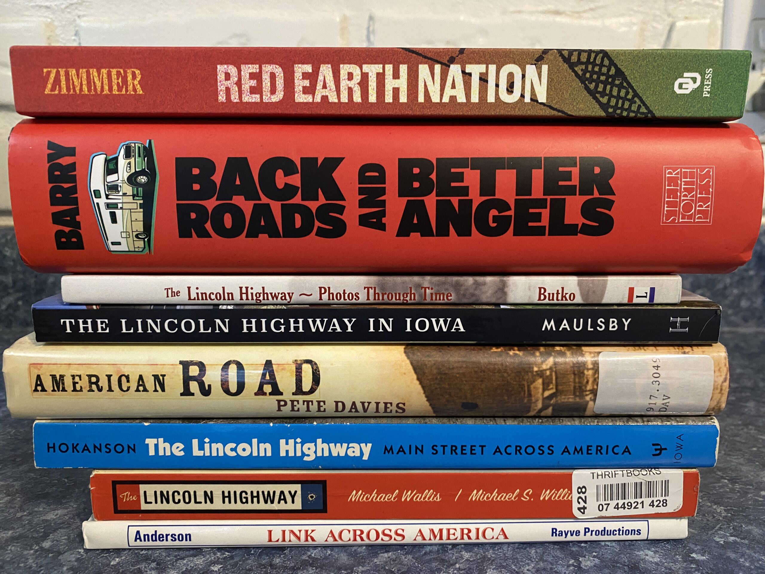
The book that I am most excited about reading is Eric Steven Zimmer’s Red Earth Nation: A History of the Meskwaki Settlement (2024).  Located in Tama County, Iowa, the Sac & Fox Tribe of the Mississippi in Iowa, is known as the Meskwaki Nation, or the “People of the Red Earth.”  The Meskwaki Nation purchased an 80-acre parcel of land along the Iowa River in 1857. That parcel has grown to more than 8,000 acres. Zimmer spent ten years writing this book  to be certain that he got it right for the Meskwaki Nation.  Through the Iowa Meskwaki Nation’s story, he explores the #Landback movement of Native nations. 

Back Roads and Better Angels: A Journey into the Heart of American Democracy by Francis S. Barry (2024)

Back Roads and Better Angels: A Journey into the Heart of American Democracy by  Francis S. Barry (2024) focuses on a man and his wife who take the ultimate RV trip across America along the Lincoln Highway. Barry uses Abraham Lincoln and the Civil War as a guide to gain insight on Americans today amidst recent political divisions. I am hoping that this book is inspirational to a point that it can propel me through the 560 pages. 

The Worldly Game: The Story of Baseball in the Amana Colonies by Monys A. Hagen edited by Peter Hoehnle

The newest book to be published about the Amana Colonies that I am looking forward to reading is The Worldly Game: The Story of Baseball in the Amana Colonies by Monys A Hagen, edited by Peter Hoehnle, published by Penfield Books (2024). When baseball was first introduced to the Colonies, the elders deemed the sport forbidden (verboten). With little else to do in their free time, the game quickly became the most popular sport of the seven Amana Colonies. Then the automobile was introduced to the colonies and the communities were suddenly introduced to the world.  Baseball’s popularity dwindled. 

The Iowa Baseball Museum of Norway  located north of the Amana Colonies would be a great stop to get the full experience of this book.

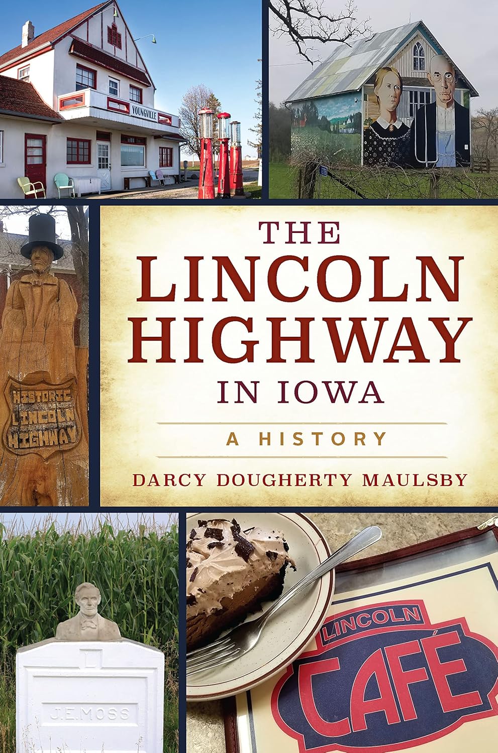
The Lincoln Highway in Iowa: A History by Darcy Dougherty Maulsby (2023).

The Lincoln Highway in Iowa: A History is a recent book by Darcy Dougherty Maulsby (2023).  I must admit that I have this book but that I haven’t read it all the way through yet. It has functioned more as a source book for me to find an interesting place or story. Which makes it a great glove compartment book for a trip on the byway.

Brian Butko has written several books on the Lincoln Highway and kept an awesome Lincoln Highway blog from 2007-2022.  I recently purchased his, The Lincoln Highway ~Photos Through Time (2013).  The book I (and every  byway traveler) is looking forward to most by Brian is, Scouting the Lincoln Highway: Adventures on the 1928 Safety Tour in an REO Speed Wagon.  And honestly, I am full of anticipation for his first novel, The Quarry, described as “a haunted historical mystery.” Will a certain historic highway be mentioned?…


The Lincoln Highway by Amor Towles German

Speaking of fiction, there is one little book that has brought much attention to the Lincoln Highway. That is a not-so-little book by Amor Towles, The Lincoln Highway (2021). And… there is a movie in the works! Towles is an expert storyteller and although I haven’t read this one yet, I am a huge fan of his style.  His story twists can change the view of what a story is really about. Talking about exposure, I just found out that the book has been printed in Spanish, Swedish, Italian, German, and Chinese.

The Lincoln Highway Amor Towles Chinese
Niland Corner by Paul Berger

Another fiction book that I found with a setting of the Lincoln Highway is, Niland Corner, by Paul Berge (2021).  Berge is an aviation writer and this quick little story is sure to put a smile on your face as the story weaves around the Niland Corner.

is An American Songline: A Musical Journey Along the Lincoln Highway by Cecelia K Otto, 2015

The last book I will talk about here is An American Songline: A Musical Journey Along the Lincoln Highway by Cecelia K Otto (2015). What a concept this book is based on! Cece traveled the Lincoln Highway (all of it) and gave concerts of vaudeville-era music in every state she passed through. The book follows her journey bringing music and history together. Oh yes, and there is a CD of the music you’ll need also!

Here are the locally owned book venues that I was able to find on the Lincoln Highway Heritage Byway . Send me the ones that I missed!

Dog-Eared Books in Ames

The Book Shoppe, Inc. in Boone

Swamp Fox Bookstore in uptown Marion

Next Page Books  in Historic New Bohemia in Cedar Rapids


Next Page Books New Bohemia Cedar Rapids Iowa
Dog Eared Books Ames Iowa

Along the Iowa Valley Scenic Byway I was able to find:

Amana Heritage Society Museum is the go-to place for books on the history of the Amanas.

Bumble Books in downtown Amana is taking on the environment by specializing in Print-On-Demand books by independent authors, they also sell new and used books.

Fireside Winery, just outside of Marengo, has a novel new Storyteller book club at the winery! They order their books from Dog-Eared Books in Ames!

Storyteller Book Club Fireside Winery
Bumble Books Amana Iowa

Let me know what books you are reading for the byways.

Let me know where you get your books on the byways.

And let me know where your favorite place to read your byway book is.

A little piece of useless information about me:

Drake Hokanson’s 1988 book was a book I picked up back in 1989,

I didn’t know then what propelled me to do so….


See you on the byways!

Lincoln Highway Heritage Byway A National Scenic Byway

Add to my book lists below!

Lincoln Highway Heritage Byway: This list includes Iowa specific books but does not include other state specific books that exist. Available at Lincoln Highway Trading Post:  Buy here first to support the Lincoln Highway Association. If they do not have your book check your local bookstore as they can order and ship to you if the book is still in publication. Thrift sites may have a book that is out of publication.

Scouting the Lincoln Highway: Adventures on the 1928 Safety Tour in an REO Speed Wagon by Brian Butko, Not published yet

Red Earth Nation: A History of the Meskwaki Settlement by Eric Steven Zimmer, 2024, 358 pages

Back Roads and Better Angels: A Journey into the Heart of American Democracy by Francis S. Barry, 2024

Lincoln Highway: Discover America’s Forgotten Main Street by Publications International Ltd., 2023; 144 pages

The Lincoln Highway in Iowa: A History by Darcy Dougherty Maulsby, 2023; Iowa

 After Ike: On the Trail of the Century-Old Journey that Changed America, Michael S. Owen, 2022; 224 pages; available at Trading Post 

Greetings from the Lincoln Highway: A Road Trip Celebration of America’s First Coast-to-Coast Highway by Brian Butko (Centennial edition w/revised text and new images 2013, 2019) (3 total editions)

Ford Model T Coast to Coast: A Slow Drive across a Fast Country by Tom Cotter, 2018; 224 pages; available at Trading Post

An American Songline; The Book: A Musical Journey Along the Lincoln Highway by Cecelia Otto, 2015; 309 pages; available at Trading Post

Across the Continent by the Lincoln Highway by Effie Price Gladding, 2015; 120 pages

The Lincoln Highway: Photos Through Time, Brian Butko, 2013; 136 pages; available at Trading Post

Lincoln Highway Companion: A Guide to America’s First Coast-To-Coast Road, by Brian Butko, 2009; 193 pages

America’s First Highway by Greg Roza, 2009; ages 9-12; 32 pages

 The Lincoln Highway: Coast to Coast from Times Square to the Golden Gate by Michael Wallis and Michael S. Williamson, 2007; 304 pages

Lincoln Highway: The Road My Father Traveled by D. Lowell Nissley, 2006; 212 pages

American Road: The Story of an Epic Transcontinental Journey at the Dawn of the Motor Age by Pete Davies, 2002; 274 pages

All the Way to Lincoln Way: A Coast to Coast Bicycle Odyssey by Bill Roe, 2000; 192 pages

The Pacesetter: The Untold Story of Carl G. Fisher by Jerry M. Fisher, 1998; 440 pages

Link Across America: A Story of the Historic Lincoln Highway by Mary Elizabeth Anderson and Randall F Ray, 1997; ages 7-13; 52 pages; available at Trading Post

The Lincoln Highway: Iowa by Gregory M. Franzwa, 1995; 187 pages Iowa

The Lincoln Highway: Main Street Across America by Drake Hokanson, 1988; 256 pages

The Lincoln Highway: The Story of a Crusade That Made Transportation History by Lincoln Highway Association, reprint of 1935 edition (reprints: 1995, 2018, 2022); 396-204 pages

The Complete Official Road Guide of the Lincoln Highway, reprint of 1924 edition (5th Edition); 566 pages; available at Trading Post

The Complete Official Road Guide of the Lincoln Highway, reprint of 1916 edition (2nd Edition)- print on demand with a leather cover through Walmart

The Complete Official Road Guide of the Lincoln Highway, reprint of 1915 edition (1st edition of 5 editions); 160 pages

Pan-Pacific International Exposition Miniature View Book by Robert E. Reid, 1915; 66 pages; available at Trading Post

Hints to Transcontinental Tourists Traveling on the Lincoln Highway by FH Trego, reprint of 1914 edition; 12 pages; available at Trading Post

Lincoln Highway: Route Road Conditions and Directions by FH Trego, reprint of 1913 edition; 32 pages; available at Trading Post

Fiction: The Lincoln Highway by Amor Towles, 2021

Fiction: Niland Corner by Paul Berge, 2021 Iowa

Iowa Valley Scenic Byway Iowa Prairie Rivers of Iowa

Iowa Valley Scenic Byway:

Red Earth Nation: A History of the Meskwaki Settlement by Eric Steven Zimmer, 2024

The Worldly Game: The Story of Baseball in the Amana Colonies by Monys A. Hagen, published by Penfield Books, 2024.

A Change and A Parting: My Story of Amana by Barbara Selzer Yambura and Eunice W. Bodine, 2022; 264 pages

A Century of Amana Life: Echoes of Elise by Jeremy H. Berger, 2020; 297 pages

Amana Colonies, Iowa, Images of America, 1932-1945 by Peter Hoehnle, 2016; 130 pages

The Inspirationists, 1714-1932 by Peter Hoehnle, 2015; 374 pages

The Amanas Yesterday by Joan Liffring-Zug Bourret, John Zug, 2013, 48 pages

German Recipes Old World Specialties and Photography from the Amana Colonies by Sue Roemig Goree and Joanne Asala, 2013; 128 pages

The Amana People: The History of a Religious Community by Peter Hoehnle, 2003; 96 pages

Village Voices, Stories from the Amana Colonies by Various Authors published by Free River Press, 1996

Ghost of the Amana Colonies by Lori Erickson, 1988; 172 pages

Amana Colonies by Joan Liffring-Zug Bourret and John Zug, 1985 (2nd Edition)

Amana Today: A History of the Amana Colonies from 1932 to the Present by Lawrence L. Rettig, 1975; 249 pages

Historical Fiction by Melanie Dobson: Legacy of Love Series books 6 & 7: The Society, 2020; 320 pages and The Stranger, 2020; 299 pages

Historical Fiction by Judith McCoy Miller Home to Amana Series and Daughters of Amana Series, 2010-2014

Oktoberfest in the Amanas: It’s more than beer

Oktoberfest in the Amanas: It’s more than beer

Millstream brewery in the Amana Colonies Millstream Facebook page

Millstream Brewing is Iowa’s Oldest Brewery Post-Prohibition and brews the Amana Colonies Official Oktoberfest Brew. Photo courtesy of Millstream on Facebook.

On Oct 4, Iowa’s oldest Annual Bavarian-style Oktoberfest celebration will be kicking off in the heart of the Amana Colonies. There is no other celebration like it in the state of Iowa as the Amana Colonies (located just south and west of Cedar Rapids), is a unique cultural lesson in its very existence. The Community of True Inspiration made the Amanas their home in 1855.  They practiced a fully communal lifestyle until 1932. Today, the community keeps the history and traditions alive by hosting celebrations throughout the year.  Every October the three-day Oktoberfest event packed full of music, dancing, bratwursts and pretzels, and of course German beer in a massive bierkrug (beer mug) takes over the Amanas. 

When the Amana Colonies were first settled in the 1800s they quickly established 5 breweries and numerous vineyards. With prohibition those breweries closed by 1884. It wasn’t until 1989 that the first post-prohibition brewery opened in Iowa, Millstream Brewing Co.  As their brewery became successful, the owners decided to add an authentic German Bierhalle to the Amana Colonies. The Millstream Brau Haus opened in 2016 offering one of a kind specialty beers only available in the Amana Colonies. German-style pub food is also available here.


German-style pub food is available at the Brau Haus. Photo by M. Kellner

German-style pub food is available at the Brau Haus. Photo by M. Kellner

The Amana Heritage Society Museum maintains a group of museums that display and interpret artifacts from the 1700s to the present with a focus on the communal period of Amana (1855-1932). The historic society has its work cut out for them as they maintain a communal-era kitchen, cooper shop, blacksmith shop, church museum, research library, the working High Amana General Store, and the museum and bookstore making history available to the public.

The Amana Heritage Museum

The Amana Heritage Museum. Where you can find books, information, and is an audio tour stop. Photo by J. Hau

The Amana Community Church in Homestead is managed by the Amana Heritage Society. A recent maintenance overhaul has begun on the building. The church is also a stop on the Iowa Valley Scenic Byway Audio tour.

The Amana Community Church in Homestead is managed by the Amana Heritage Society. A recent maintenance overhaul has begun on the building. The church is also a stop on the Iowa Valley Scenic Byway Audio tour.

The exterior and interior of the High Amana Store, which was established back in 1857, remain virtually unchanged today. This working store is managed by the Amana Heritage Society.

The exterior and interior of the High Amana Store, which was established back in 1857, remain virtually unchanged today. This working store is managed by the Amana Heritage Society.

 A map of the 7 Colonies of the Amanas.

Historic map of the 7 Colonies of the Amanas.

There remains much to do in all of the Amana Colonies. 

The annual Oktoberfest parade happens Saturday morning at 10 am in Amana. The theme this year is “Famous Frauen,” to highlight amazing women. There will be plenty of activities for the kids to do at the Oktoberfest Kinderplatz (kids area) while the adults are having fun with competitions such as:  the keg toss, log sawing, nagelhauen (nail driving), eisenmann (strength), brat eating, or the best yodeler competition!  Download the official Oktoberfest brochure.

Parking will be limited so be sure to catch the shuttle.

Parking will be limited so be sure to catch the shuttle!.

Kids activities are also available check out the official brochure.

Kids activities are also available check out the official brochure at the link above.

.


Festhalle BarnThe Festhalle Barn is a restored century-old dairy barn that was remodeled to function as an event venue. Annually, the Festhalle Barn hosts the main event of the Oktoberfest celebration and the Tannebaum Forest. It can be rented by the public as well.


While the official Oktoberfest activities happen at Festhalle Barn (admission charge), Millstream Brewing, Hotel Millright, and the Ox Yoke Inn have live music all weekend as well.  Demonstrations such as chainsaw carving, chair caning, and tours of the Woolen Mill and the Amana Furniture and Clock Shop are other must-dos.

The interior of the Woolen Mill, historic photo.

The interior of the Woolen Mill, historic photo.

The interior of the Woolen Mill today.

The interior of the Woolen Mill today.

The Woolen Mill today has one working building. The other buildings on the complex have been repurposed as Hotel Millright.

The Woolen Mill today has one working building. The other buildings on the complex have been repurposed as Hotel Millright.

The Woolen Mill is Iowa’s only remaining working woolen mill having been in operation since 1857. Although the original building eventually became Amana Refrigeration, the second 8-acre mill location along the Mill Race still makes and sells textiles although on a much smaller basis. The majority of the mill complex was remodeled and turned into the luxurious Hotel Millright in 2021.


The old Woolen Mill in Amana. Photographer is looking west. Photo courtesy of Amana Heritage Society.

The old Woolen Mill in Amana. Photographer is looking west. Photo courtesy of Amana Heritage Society.

View of the Woolen Mill (left) and Hotel Millright today. Photographer looking east along the Mill Race.

View of the Woolen Mill (left) and Hotel Millright today. Photographer looking east along the Mill Race.

Electric Thread, the Indigo Room, and the Lobby to the Hotel Millright today. Remaining working Woolen Mill is on the left.

Electric Thread, the Indigo Room, and the Lobby to the Hotel Millright today. Remaining working Woolen Mill is on the left.

The 1923 addition to the Woolen Mill and other expansion buildings are now part of Hotel Millright.

The 1923 addition to the Woolen Mill and other expansion buildings are now part of Hotel Millright.

 Textiles were critical to Amana’s beginnings as was the Amana Furniture and Clock Shop.

Today’s The Furniture and Clock Shop remains a thriving busisness using century-old building methods that have been passed down since 1855. This historic workshop has a viewing gallery where you can learn more about handcrafting authentic Amana Furniture while watching the craftsmen work.

The Amana Furniture Shop still makes handcrafted furniture and Clocks today.

The Amana Furniture Shop still makes handcrafted furniture and Clocks today.

Over 200 mums were used to decorate Festhalle Barn for Oktoberfest. Stock photo.

Over 200 mums were used to decorate Festhalle Barn for Oktoberfest. Stock photo.

The Chocolate Haus in central Amana.

The Chocolate Haus in central Amana.

Oktoberfest in the Amanas offers a  variety of authentic German food from pork trotters, pretzels, and strudel crafted by German artisans to sweets at the The Chocolate Haus.  So enjoy Oktoberfest in the Amana Colonies. Learn about the history and traditions and don’t forget to check out the Iowa Valley Audio Tour locations while you are in town (app to come soon)!

Iowa Valley Scenic Byway Iowa Prairie Rivers of Iowa

Bis bald on the byway!

Iowa Lincoln Highway Association Flashback: 1995, with Bob Ausberger

Iowa Lincoln Highway Association Flashback: 1995, with Bob Ausberger

Lincoln Hotel Restoration 1990-92

Lincoln Highway Original Brick at Cornell College, Mount Vernon

Lincoln Highway original brick Woodbine

He had the flat
She felt his chin
And that was that
Our Iowa

Follow the Iowa Lincoln Highway Association on Facebook and at Iowa Lincoln Highway Association – Copyright © 2024 All rights reserved. Become involved and join today: Membership – Iowa Lincoln Highway Association Follow John Fitzsimmons at https://lincolnhighwayjohnny.com

As always you can find Lincoln Highway information at: Lincoln Highway Heritage Byway or Prairie Rivers of Iowa and don’t forget the Byway Buzz.

From “Green Corn Dance” to “Powwow:” the Meskwaki Nation’s End of Summer Tradition

From “Green Corn Dance” to “Powwow:” the Meskwaki Nation’s End of Summer Tradition

Meskwaki powwow dance elders laughing

The Meskwaki Nation located in Tama County has celebrated the end of summer every year for over 100 years with the Meskwaki Annual Powwow. Family and friends travel from all over the country every year to participate in the Annual Powwow which features dancing, singing, handcrafts, food, games, and fun. Dance styles and content have evolved over the years but the reminiscing, reconnecting, and celebrating unity remains the focus of the event.

Corn Meskwaki powwow

Meskwaki Powwow Facebook page

Before 1900, the Meskwaki Tribe would gather every fall during harvest to celebrate the harvest of the crop with a feast. The village was centrally located and the people would celebrate while making final preparations for the storing of the crop for the coming year. They called this celebration the “Green Corn Dance.”  

Then in the early 1900s, the smallpox epidemic ran through the village and the federal government burned the village homes to eradicate the disease. The government then built the settlement houses that were spread out across the land in hopes of preventing future diseases. This caused a separation of the population and the arrival of individual crop lands and various harvest times instead of a central common harvest.  

CW Wright State Historical Society Wikiup

CW Wright, State Historical Society of Iowa

Powwow Lincoln Highway 1917 Meskwaki Nation

Meskwaki Powwow Facebook Page

To fill the missing sense of celebratory community, from 1902-1912, the Meskwaki Tribe gathered at the old village site and a new event was created but without the harvest. “Field Days” had replaced the “Green Corn Dance.”

“Field Days” became popular with more and more people from outside the settlement. The Meskwaki realized that they could share their culture with the outside world and possibly provide income for the settlement during this festive event and so in 1913 the Chief appointed 15 men to plan the celebration. These men changed the event name to “Powwow” and moved it to the current Powwow Grounds.

The Meskwaki Annual Powwow is now the largest event of its kind in the nation. It has only been canceled during World War II and during the Covid-19 outbreak of 2020/2021.

Powwow Lincoln Highway 1917 Meskwaki Nation

Meskwaki Powwow Facebook page

All are invited and encouraged to attend the Meskwaki Annual Powwow with open minds and open hearts to learn from the Meskwaki culture during this festive event. Various games, activities, and food vendors as well as traditional foods are available to all.  Powwow etiquette is an important way to show your respect and to ease your comfort in an unfamiliar cultural environment.  The celebration begins on Thursday August 8 and last for four days with Grand Entry beginning at 1 pm and 7 pm daily.

Meskwaki Powwow jam iowa

Meskwaki Powwow Facebook page

Meskwaki powwow flatbread

Meskwaki Powwow Facebook page

The Grand Entry can now be livestreamed if you can’t make it in person. New this year is the Bible’s Fatboy Powwow Highway Ride benefiting the Meskwaki Band Florida Trip; grab your cars and bikes and meet at the Meskwaki Travel Plaza 9:30 am Aug 10th and ride the gravel-to-grounds route. What a way to celebrate the end of summer! 

The Meskwaki Powwow Grounds are along both the Lincoln Highway Heritage Byway and the Iowa Valley Scenic Byway

Visit Prairie Rivers of Iowa for more Byway Buzz.

Iowa Valley Scenic Byway Iowa Prairie Rivers of Iowa
Prairie Rivers of Iowa

Freedom Rock Tour and a Liberty Rock on the Lincoln Highway and the Iowa Valley Byways

Freedom Rock Tour and a Liberty Rock on the Lincoln Highway and the Iowa Valley Byways

Freedom Rock in Boone along the Lincoln Highway

Hello byway travelers!

I am writing today from the National Lincoln Highway Association’s Annual Conference in Elkhart, Indiana! Since I am here all week I thought that I would share with you the feature that I submitted for the Iowa Byways monthly newsletter. If you would like to learn more about Iowa’s other byways be sure to sign up for the newsletter at: https://iowadot.gov/iowasbyways

It seems fitting that as we get ready to celebrate America’s Independence Day that we should celebrate the Lincoln Highway Heritage Byway. The Iowa byway gained National Scenic Byway status in 2021 for the historical significance to our country as the first planned transcontinental highway across the United States.

On July 1, 1913 Carl Fisher’s coast-to-coast rock highway was officially named the Lincoln Highway after the 16th President of the United  States, Abraham Lincoln. The Lincoln Highway Association was officially incorporated and tasked with promoting the Lincoln Highway to local governments and the public. It was no coincidence that Lincoln, a martyr for freedom, was chosen by Henry Joy (the association’s first president) to represent the roadway. Lincoln was a martyr of freedom and the idea of having an improved road across the country that anyone could use to move about freely was the goal. The road soon became known as the “Main Street Across America” and an avenue to a new life for many. 

The Lincoln Highway has another significant date in July and that is July 7, 1919 when the first of its kind Transcontinental Motor Convoy left Washington DC to meet up with the Lincoln Highway in Gettysburg and traverse the route. There were 81 military vehicles, 37 officers, and 258 enlisted men who began the trip. Not all of them made it the distance. The Convoy traveled through a muddy Iowa from July 22- July 28th. Read more on the Transcontinental Motor Convoy

Many of the 43 communities across Iowa’s Lincoln Highway choose the fourth of July as their community’s annual town celebration. Belle Plaine has held a July 4th celebration for many years and good ol’ George Preston would even pull his two-headed pig in the parade. Mount Vernon’s Lincoln Highway Nitty Gritty has about the best name out there and highlights history through antique displays and shopping in the streets and local businesses. The larger towns of Clinton, Council Bluffs (at the historic General Dodge House), and Ames have annual celebrations as do some of the smaller towns like Logan. But the town that wants to really own the fourth of July is Marshalltown, the location of Iowa’s Veteran’s Home which also happens to be one of the largest Veteran’s Homes in the country. 

All this talk of freedom and veterans brings us to the topic of this month’s newsletter, Iowa’s Freedom Rocks. The first Iowa Freedom Rock was painted in Adair County in 1999. Artist, Ray “Bubba” Sorensen II wanted to give veterans unique recognition on Memorial Day.  Eventually Bubba began a Freedom Rock Tour, where his goal was to paint a Freedom Rock in every county honoring the history and veterans who had connections to the county. Bubba has even started a 50 State Freedom Rock Tour. There is now a Freedom Rock in every one of Iowa’s 99 counties, a 100th one in Altoona, and a Liberty Rock in the Lincoln Highway community of Glidden.  Read more about this special rock, Freedom Rocks along the byways and other byway events in the July newsletter!

Safe Travels!

Iowa’s Scenic Byway Coordinators

Greene County Freedom Rock
Carroll County Freedom Rock
Boone County Freedom Rock

The Lincoln Highway Heritage Byway traverses through 13 Iowa counties.  Of those 13 counties, five of the communities are home to their counties’ Freedom Rock but there is another rock that is on the Lincoln Highway that is not a Freedom Rock. It is the Glidden Liberty Rock. The Carroll County Freedom Rock was complete when the community of Glidden approached Bubba wanting their own rock. The fact that Glidden has ties to the beginning of WWI and the end of WWII inspired the artist to say yes. The Glidden Liberty Rock portrays Merle Hay, the first Iowan and one of the first three Americans killed in WWI, the “Enola Gay” plane that dropped the bomb to end WWII, injured veteran Ralph Neppel, and a Vietnam Vet Donald Sparks, MIA.

Liberty Rock in Glidden on the Lincoln Highway
Glidden Liberty Rock

The Lincoln Highway Freedom Rock Tour also includes: Clinton County (Clinton), Cedar CountyLinn County (the 99th rock completed), Benton County, Tama County (features Meskwaki Code Talkers), Marshall County (Marshalltown), Story County, Boone County (Boone) , Greene County (Jefferson), Crawford County , Harrison County (Lincoln Highway/Loess Hills Interpretive Center), and Pottawattamie County (Lewis & Clark Trail).


Story County Freedom Rock
Tama County Freedom Rock
Tama County Freedom Rock from road
Linn County Freedom Rock

Located in the Gateway Park & Preserve in Marengo, the Iowa County Freedom Rock is protected beneath a lighted pavilion.  One side of the rock features Marengo born Marine Sgt. Major Bradley Kasal. Kasal was awarded the Navy Cross for his heroic action during a firefight in which he was severely injured during Operation Phantom Fury in the Gulf War. Williamsburg native, Eugene Ely, an aviation pioneer who was credited with the first shipboard aircraft take-off and landing is featured beneath the American flag. Army Air Force veteran Dr Burns Byram is also featured on the rock. Byram would fly his restored military plane, “Tangerine” low over the town of Marengo to announce that the doctor had arrived. Other Iowa Valley Scenic Byway counties include the Benton County Freedom Rock which features Army, Navy, and Air Corps heroes and the Tama County Freedom Rock which features the Meskwaki Code Talkers.

Benton County Freedom Rock
Cedar County Freedom Rock
Clinton County Freedom Rock

I hope you have enjoyed this Lincoln Highway and Iowa Valley Freedom Rock Tour. Have a wonderful July and I will see you on the byway!!

Where Was I on the byway? Part 1

Where Was I on the byway? Part 1

Where Was I Hot beef sandwich

“Where Was I on they byway?” began as a post on our Facebook page that was telling people, “Hey look what famous Lincoln Highway Café is open again!” Since I began work as the byway coordinator for the Lincoln Highway Heritage Byway, there was speculation as to whether or not the beloved Cronk’s Café in Denison was gone forever or if the new owners would save the tradition. I had seen the Cronk’s sign lit up on a previous trip, but the restaurant wasn’t open. On this trip it was open and what better way to announce to our followers than with a good old fashioned hot beef sandwich with mashed potatoes and gravy (or pork in this case)? The post was very popular, most people knew where I was and they were just as excited as I was that Cronk’s would live on in the form of Cronk’s Café American and Mexican Restaurant.

.

Cronk's Cafe postcard
cronks cafe
cronks party room
cronk's cafe sign
American and Mexican
Cronks inside
Wheatland Calamus bridge

This Facebook post of the bridge and asking, “Where am I on the byway,” was an impulsive live post as I was doing sign inventory on the byway. Bridges on the byway are so beautiful in whatever form or shape they are in, and people love them!  Everyone knew that I was at the Wapsi Bridges between Calamus and Wheatland.  I learned from followers that the bridges had been closed since the 1990s and that there were holes in the steel underneath that were big enough for a person to get through.  The bridges here are actually a series of three bridges. Funding is secured for the replacement of the middle bridge (with a wider decking) and the county is currently seeking funding for the western-most bridge.  A Pony Truss bridge is at the eastern side of the section of roadway and will not be restored as a roadway. It will be wonderful to open this stretch of the Lincoln Highway Heritage Byway to drivers again! I also learned that there was an amusement park here!!

Wheatland Calamus bridge over Wapsi River
wheatland calamus bridge Wapsi River
Pony-tress bridge over the wheatland calamus bridge
Where Was I on the byway?


Where was I on the byway that I saw this guy?

I had gotten a kick out of this guy when I toured this museum. Our friend had his dental work (yes, real teeth) done in a historical dentist chair at one of the many buildings on site. A 1928 Lincoln Highway marker is at its original location here tucked near a lilac shrub. There are many buildings to check out from the 1800s, hiking trails, a video presentation, a gift shop, and a weekly farmer’s market from May to October. The highlight is at the top of the hill where you can stand on the ridge by the Lincoln Highway metal railing and take a selfie viewing the Lewis and Clark Trail, the Western Skies Scenic Byway, the Loess Hills National Scenic Byway and the Lincoln Highway Heritage Byway!

So where was I?                                       

I was at the Harrison County Iowa Welcome Center and Historical Museum!

Harrison County Iowa Welcome Center
Harrison county welcome center museum display
Welcome Center gas station picnic area
Harrison County Welcome Center Lincoln Highway bridge model
Welcome Center Selfie Station on Lincoln Highway Heritage Byway National Scenic Byway
Where was I on the byway?

This post was the first regular Wednesday, “Where Was I on the byway?” Alas, our followers did know exactly where I was!! : Answer to yesterday’s “Where Was I on the byway?” is atop the hill ridge between Ogden and Boone in the Des Moines River Valley. Seven Oaks Recreation – Boone IA is located on the same ridge about a 1/2 mile south on Hwy 30.  (photo credit of Seven Oaks goes to Jeff Robak posting in I grew up in Iowa!). 

Seven Oaks
Where was I on the byway?

This post was one of my favorites although highly controversial in the Lincoln Highway world. I thought it was incredibly interesting and educational and hopefully I opened some minds.

Here is the post:  I am always checking the Lincoln Highway Association map to see where any concrete Lincoln Highway markers are. I had to do some searching to find these two, but I found them! Where was I? 

The comments were of surprise (the surprise emoji) and shock and I quickly learned why. I will answer the “Where Was I?” first. 


Wednesday’s Where Was I on the byway? …was Carlyle Memorials in Denison, IA.

The three original concrete Lincoln Highway markers lay on the ground on the west side of the building and according to the National Lincoln Highway Association map, at one time served as a wheel block for parking. This unique use for the damaged markers does allow for a good study in how they were constructed. You can see that the colors were all created separately and laid in the posts.  This also shows us that the color is IN the concrete.  If you have an original marker on your property, do not use paint to touch it up.  A good power-wash is all that is needed to refresh it!  

I also learned from followers that the 1913 cornerstone was from the St. Rose of Lima Catholic Church/School from Denison. Carlyle Memorials is storing it for them as they have often done for other Denison residents. 


Wanted Lincoln Highway markers

I may be frowned upon by some in the Lincoln Highway Association for my opinion, but I say to, “Value what you have as you have it.”  In 1928 there were 2,436 markers installed by the Boy Scouts at approximately 1 mile apart. As time continues to pass many of the markers have been lost and rarely can you find one in the original location. The markers at Carlyle Memorials could have ended up buried in the ground on a farmer’s land somewhere or (more likely) in a DOT’s dumpsite. They aren’t missing. They are right there for you to discover (with the owner’s permission) where you can see how they were made to last 104 years along a highway.  I would like to add that the owners are 3rd generation small business owners and completely respect and honor their history and the history of the Lincoln Highway.  


 With that, I will end this blogpost. I am enjoying the “Where Was I on the byway?” postings and learning from you, the readers. I hope to give you a fairly accurate count of how many 1928 markers that Iowa still has in the coming year (it is over 30). Keep following me and I will see you on the byway!

Where Was I on the Byway sign over the Iowa Byways Lincoln Highway Heritage Byway logo

Farm District on the Lincoln Highway is in Danger of Losing National Status

Farm District on the Lincoln Highway is in Danger of Losing National Status

The Meyer’s Farmstead Historic District is located one block north of the Lincoln Highway Heritage Byway in Lisbon. The Farm District is part of the Pleasant Grove Heritage Park. It is a two block walk from Lincoln Square Park which is located in the heart of the Lisbon Main Street Historic District. The Farmstead, the Lincoln Highway Heritage Byway, and the Main Street Historic District are all nationally recognized as significant to the history of development in America.  Iowa’s travel industry is focusing on Agritourism in 2024.  It is more important than ever to realize the value of our history, our stories, and how they are being told.

Google maps with Meyers Farmstead Historic District, the Lincoln Highway, and Lisbon Main St Historic District

15.33 acres of the Meyer farm was sold to the City of Lisbon for the development of a park in 2019. For the next six years the City of Lisbon, the Lisbon Historic Preservation Commission (LHPC), and the Lisbon Parks and Recreation have been developing the Heritage Area. From a catch-and-release pond to tours of the farmstead, the plan is in motion. 

Lincoln Square Park Lisbon Main St Historic District
The fence post, water trough, and 3 historic barns are significant to the historic property.
Meyers Farm Historic District barn

A top priority for the Preservation Commission was to get the Meyers Farmstead listed on the National Register of Historic Places.  The farmstead collective was deemed significant for important agricultural trends of livestock and dairy farming in the late 19th and early 20th centuries and was listed in 2021. The agricultural buildings are significant as they represent the rarity of buildings still existing from that time period. They are also significant representives of adaptive uses as the industry changed (NRHP listing for Meyers Farmstead).

Now on the National Register of Historic Places, the Preservation Commission was now looking for help and partners. In August of 2023, the Pleasant Grove Heritage Park including the Meyers Farmstead Historic District was named an emerging site with the Silos & Smokestacks National Heritage Area (SSNHA). The SSNHA is an organization under the umbrella of the National Park Service. The SSNHA’s mission is “to preserve and tell the story of American agriculture and its global significance.” They connect partners and resources with the goal of creating a consistent professional preservation and interpretation standard. This was exactly what the Preservation Commission needed.

Silos & smokestacks

The plan for the natural landscape at the Heritage Park progressed quickly when a REAP grant was awarded last November.  The grant will be used to reconstruct 10 acres of diverse tallgrass prairie. The prairie will contribute to the farm’s story from prairie to farm. It will also improve water quality and wildlife habitat. The planting is scheduled for May 2024. 

Finally, in November of last year, the The Mount Vernon-Lisbon Sun reported that the Lisbon City Council approved a contract between the Lisbon Historic Preservation Commission (LHPC) and the City of Lisbon with OPN Architects. The contract is to prepare a preservation plan for the barns in the Historic District.  Rebecca Hess from LHPC described perfectly what the barns had endured, “The two barns and corncrib/hog house survived the tornado of 1908, the derecho of 2020, and the F2 tornado of 2023. Our goal is to ensure their structural integrity in order to preserve them for future generations.” Under the preservation plan, each of the three historic barns would have its own plan for rehabilitation created by professionals in historic preservation following historic preservation standards. Progress for the development of the park was coming together. 

2020 derecho winds
Meyers Farmstead Historic District inside damaged barn

Fast forward to mid-March of this year. The City of Lisbon and the Lisbon Historic Preservation Commission (LHPC) were told by the city’s insurance company to demolish two of the barns and fence the third one.  The barns would no longer be covered for liability by the insurance company. No one disputes that the barns should be fenced off from public access until they can be fully rehabilitated.  If the barns are demolished, the Meyers Farmstead Historic District will lose the designation of National Historic Register status, the Silos & Smokestacks support, and the means to receive any grants to help rehabilitate any of the barns. This would be a huge setback for the development of the Heritage Park. 

Marc Mohn from the Preservation Commission sums up the current status of the Historic District on their Facebook page: “The Lisbon Historic Preservation Commission (LHPC) is working closely with the City of Lisbon to find a solution for the insurance issues presented by the barns at the Pleasant Grove Heritage Park. The commission is meeting with city officials and contractors to gather and communicate information to stakeholders in a tireless effort to preserve and protect these unique structures, along with the history and character they bring to our community. Our goal has always been and will continue to be the preservation of Lisbon History to draw visitors, revenue, and strengthen the community’s sense of identity and place.”

Meyers Farm Historic District barn

The City Council meets on May 13 to decide the fate of these barns. The location of the Meyer Farmstead Historic District along the Historic Lincoln Highway and blocks from the Lisbon Main St Historic District is ideal for telling the Agritourism story. The story will be incomplete without them. If you would like to voice your support for rehabilitation of the three nationally significant barns in Lisbon you can email the mayor and city council members directly.  You can also plan on attending the May 13 Council meeting at Lisbon City Hall. You can comment here as well.

Thank you to The Lisbon Historic Preservation Commission for the photos and information, to the “Mount Vernon-Lisbon Sun” for their responsive reporting on preservation efforts, to the Silos & Smokestacks organization for their support and logo use, and to all of those who support the Lincoln Highway Heritage Byway and Agricultural Heritage locally, regionally, or nationally. –See you on the byway!

Raccoon River Valley Trailhead in Jefferson Honors History and the Lincoln Highway

Raccoon River Valley Trailhead in Jefferson Honors History and the Lincoln Highway

Coming from the east along the Lincoln Highway through the town of Jefferson, there is a location where the car seems to be drawn to a stop and the traveler is compelled to get out and explore. On the north side of the road is a beautiful, landscaped area with plants and sculptures while on the south side there is the restored and welcoming Milwaukee Railroad Depot (along with the county Freedom Rock!). Both sides of the road are part of the Raccoon River Valley Trail (RRVT) trailhead.

north trailhead park

The Railroad Years

The Chicago & North Western Railroad brought the railroad tracks to town in 1866, and by 1906 the Milwaukee and St Paul routes ran through Jefferson as well connecting Des Moines and the Iowa Great Lakes Region. Replacing smaller versions of a depot, the current depot was built from a standard Milwaukee plan between 1906 and 1909. There was once a cast iron horse trough that was attached to the building. Because Jefferson was the county seat of Greene County, the depot here was larger than most with two waiting rooms, indoor plumbing, and an express and baggage room. Greater ornamentation was also given to the structure.Jefferson Milwaukee depot historical photo

Milwaukee depot now 2023 Jefferson2023 Milwaukee depot JeffersonThe Lincoln Highway Cruises In

By 1913, the Lincoln Highway was proposed and its paving across Greene County came soon afterward from local and city funding. The city square was just a few blocks west of the Milwaukee Depot, and in 1918 a grand Classical Revival style building made of limestone was built to replace the brick county courthouse. In that same year, resident E.B. Wilson donated a statue of Abraham Lincoln to honor the Lincoln Highway and the new courthouse. This new ease and popularity of automobile travel became the preferred way to get from place to place. By 1952 the passenger service on the Milwaukee RR was discontinued. By the middle of the 1980s freight service ceased operation as well.

A New Use

It was time for a new use for the old railroad right-of-way. Through a vision of the Iowa Trails Council and the Conservation Boards from Dallas and Guthrie counties, the Raccoon River Valley multi-use Trail (RRVT) was born in 1987, with the first paved trail in 1989. The 12-mile addition from Jefferson to the south was completed in 1997 after Greene County joined the group. Today, the trail is an 89-mile paved surface running from Jefferson to Waukee, with plans to connect to the High Trestle Trail by the end of 2024.

One of the goals of the Raccoon River Valley Trail Association was to keep the history alive in the towns along the trail and to give new life to the communities. There are signs noting historical points of significance along the entire route, several restored or remaining train depots, and signs that remain from the railroad days.

The Jefferson Trailhead

The addition of the Milwaukee Depot Trailhead in Jefferson has been significant to telling the story of the Lincoln Highway. Thousands of bicyclists, joggers, walkers, skaters, campers, cross-country skiers, birdwatchers, hunters, fishermen and naturalists from all across the state are drawn to the Raccoon River Valley Trail.  The Lincoln Highway interpretive signs at the trailhead are only the beginning to how Jefferson tells the Lincoln Highway history.

Freedom Rock Greene County

Jefferson and the Lincoln Highway

Adjacent to the Raccoon River Valley Trail is the Greene County Freedom Rock, the 53rd in the state, and completed in 2016.  The Lincoln Highway is one of four subjects painted on the rock. In the Greene County News, October 28, 2016, artist Bubba Sorensen states that the rocks are to thank veterans for their service and to tell the unique stories of each county. The Lincoln Highway scene depicts the 1919 U.S. Army motor transport corps convoy across the Lincoln Highway and then LTC Dwight D. Eisenhower looking toward the convoy.

Approximately one block to the west of the RRVT is the Deep Rock Gas Station.  Built in 1923, the building was in use until the 1990s. The site was given to the city in 2007. Using federal EPA “brownfield” funds, the Iowa Department of Natural Resources removed the station’s seven underground tanks. Using other grants and fund sources the station was restored and rededicated in 2014. An interpretive sign is located at the station to provide more insight on the historic Lincoln Highway.

A few blocks farther to the west is the Greene County Museum and Historical Center housing Lincoln Highway memorabilia. A sidewalk painting of the Lincoln Highway roadway leads from the museum to the Thomas Jefferson Gardens and ends at the town square. An interpretive sign along the sidewalks speaks of the Lincoln Highway.

Mahanay carillion TowerAt the center of the town square is the Greene County Courthouse, the Abraham Lincoln Statue, a 1928 Lincoln Highway Marker, and the Mahanay Memorial Carillion Tower. The tower allows for elevator rides to a 128-foot-high observation deck with views to rooftop art, to the surrounding counties and to… the Lincoln Highway.interpretive signs Lincoln Highway

The Raccoon River Valley Trail is nationally recognized as an exceptional rails-to-trails conversion and was a 2021 inductee into the rail-trail Hall of Fame. It has the longest paved loop trail in the nation and connects 14 Iowa communities with a unique outdoor recreational experience. Visit their website to plan your next railroad biking adventure and to support the communities built along railroad and Lincoln Highway history!Lincoln Highway National Heritage Byway in Iowa

A Novel Way to Preserve a Historic Dining Experience

A Novel Way to Preserve a Historic Dining Experience

Lizzie's Dining Car Marengo Depot

Lizzie’s Dining Car & Caboose Bar is a new dining experience based upon the historic passenger cars that frequented Marengo from 1860-1970.  Located at 1041 Court Ave, Marengo, Iowa, the immersive experience Elizabeth Colony has created is that which can be compared to a movie set created in Hollywood. The transformation of blank walls in a brick and mortar building into a trip back in time on a railroad dining car is enhanced with “windows’ ‘ showing outdoor scenes that move at the speed of a locomotive. Only the smells and tastes of the home cooked food and drink give away the truth that this is not an actual passenger dining train. 

Elizabeth (Lizzie) was inspired to create this dining experience from the rich history of the town in which she lives. The Mississippi & Missouri (M & M) Railroad Co extended its rail line from Iowa City to Marengo in 1860. A short 18 months later the railroad line was continued to Wilson (present day Victor) and finally Council Bluffs. The train brought thousands of passengers and freight through the Iowa Valley including presidents Truman and Eisenhower and even the Liberty Bell.  The local newspaper reported in 1899 the anticipation of an Orphan Train to arrive in Marengo; several children were received in homes in Koszta, Blairstown, South Amana, and Marengo. Although Marengo received its last passenger train in 1970 and the depot was destroyed sometime in the 1980s, a portion of the original depot from Wilson (Victor) can be seen at the Iowa County Pioneer Heritage Museum

Lizzie’s Dining Car & Caboose Bar is not a historic train car. What is preserved at Lizzie’s is the atmosphere of a historic moment. It is an immersion of the senses into a time when the world was opened up to new possibilities through train travel.

The unique atmosphere was created within two walls of a downtown storefront.  As you enter the dining car, layered drapes of vintage fabric frame windows which are actually televisions. The televisions display movement through woodlands, beaches, or winter scenes.  The visual creates a sensation that you are on a moving train. On each side of the aisle are small booths igniting an intimacy for quiet conversation. Boxcar Meatloaf or Atlantic Railroad seafood and a drink from the bar completes the scene.

At the end of the railroad car is the Caboose Bar. The countertop is a single piece of cut tree that adds a natural element to the traditional “L” bar configuration found on a passenger train. The illusion is complete. 

Marengo is located in the heart of the Iowa Valley Scenic Byway where a rich collection of cultures, stories, activities, and historic scenic views remain today. The preservation of our stories is only limited by the creativity used in choosing how to tell them.   

Information for this article was informed by articles written by Bob James for 98.1 KHAK published May 16, 2023 and Marilyn Rodger, Guest columnist for the Southeast Iowa Union published Sep. 14, 2023 and Elizabeth Colony, owner/operator of Lizzie’s.  For more information on Lizzie’s Dining Car & Caboose Bar visit Facebook.