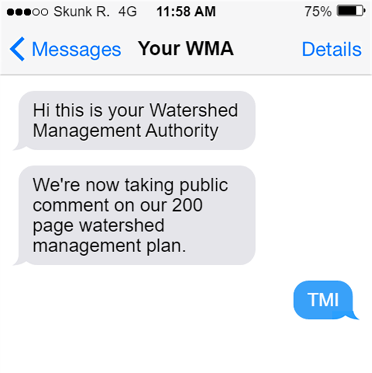
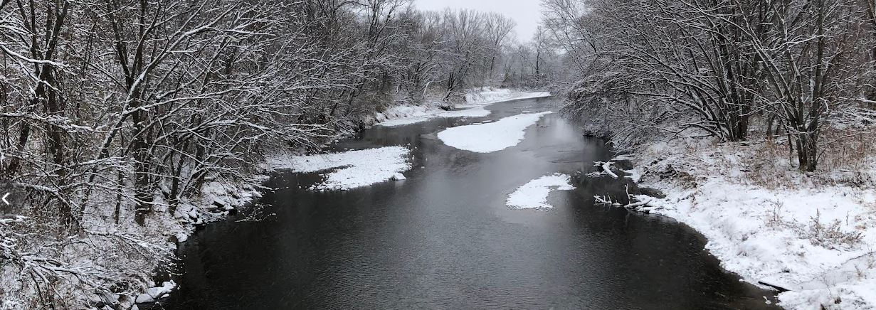
I missed the deadline for public comment on the new watershed plan for the Headwaters of the South Skunk River. We were given only two weeks and it’s a 200-page document. I can either respond with a quick text message: “TMI” (Too Much Information) or with a careful read and 700-word article. Since the deadline is passed, these comments are really meant for our readers who might be wondering what’s in the plan and what it will mean for the river.
Watershed Management Authorities (WMAs) are authorities in name only, with no taxing or regulatory authority, and given no direct funding from the state. Quarterly WMA meetings are a good forum for sharing news about water-related projects and opportunities, but some WMAs go years without managing a budget or holding a vote. Skimming the plan gives me hope that the Headwaters of the South Skunk River WMA could be more productive.
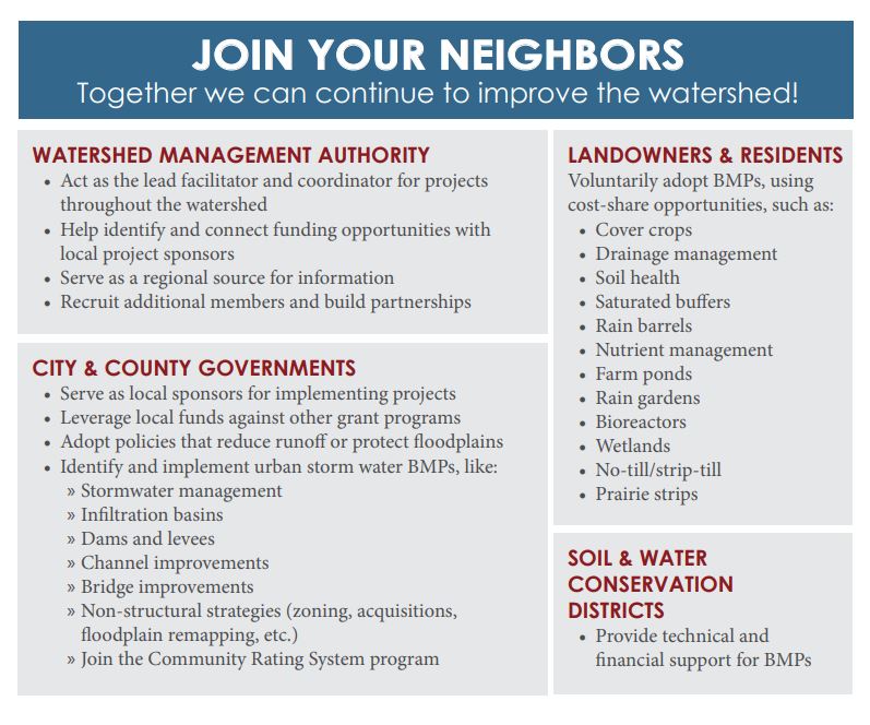
One of the most illuminating parts of the plan is this piece, which explains the role of a Watershed Management Authority, its member jurisdictions, and some of its partners. Chapter 7 fleshes out what needs to be done and who’s responsible. Chapter 8 fleshes out where they could get the money to do it. Put together, it’s a road map for getting some conservation practices on the ground, and cleaning up the water.
The report includes a lot of good technical information about pollution and solutions. I especially like Chapter 5, with its emphasis on practices that can address both nutrient reduction and other issues like habitat and flooding. There are some new ACPF maps for Hamilton County that will be very helpful for working with farmers to find suitable places for bioreactors, wetlands, and other structural practices. There’s an eye-opening section on absentee-owned farmland (section 2.03) and why it might not be as big a barrier to conservation as people think it is.
But like most watershed plans, the emphasis is on all the tasks that were completed and all the information that was compiled, rather than what was learned and why it’s important. This style of technical writing has two negative consequences:
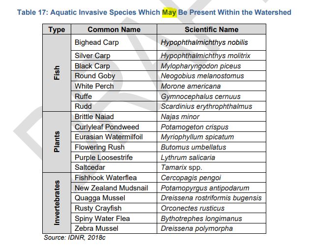
First, it makes it hard for a casual reader to tell the difference between what we know and what we don’t know. Here’s a table that looks like a list of invasive species in the watershed, but is actually a list of invasive species in the state, that may or may not be found in this river system. Then there’s a table of streams with designated uses, but it doesn’t actually tell us which ones can support fishing or swimming. Most of the smaller streams are only presumed to be swimmable, and if the DNR gets around to checking (through a field study called a Use Attainability Assessment), the rebuttable presumption would likely be rebutted. I have spent many hours dealing with the confusion resulting from this little caveat: see Chapter 2 of the Story County Water Monitoring Plan.
Skimming through page after page of maps and tables gives the impression that the watershed has been exhaustively researched, but some of the main recommendations of the plan are for additional assessments that wouldn’t fit in the budget.
- We know that normal farming practices can leak nitrogen and phosphorus, but we don’t know which areas are leakier than average, to be able to prioritize conservation practices where they can do the most good. The plan recommends additional monitoring in Hamilton County and the construction of a computer model.
- We don’t know much about flood risks and mitigation opportunities in the watershed. The plan recommends commissioning a hydrologic assessment.
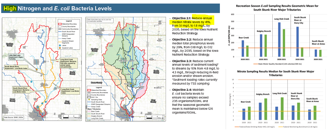
Second, it reinforces a very human tendency to see what we expect to see. If you expect to see high nitrogen levels in the South Skunk River, you have to look very carefully at the graph to realize that no, nitrate was actually quite low the last two years (a median of 3.1 mg/L) because of the drought. I didn’t notice it until my third look at the poster above. If the report is full of maps and tables that don’t seem important, or that tell you things you already know* then you stop looking carefully. And that’s how you end up setting a target that would require an 80% reduction in nitrate, relative to the long-term average (8.8 mg/L). Fortunately, I caught this during the public comment period, and authors are fixing it for the final draft. I mention this not to criticize anyone, but to illustrate why it’s important (and not easy) to connect the dots between data, their implications, and action.
* A lot of the inventory chapter reads like “Figure 1 – Central Iowa is flat, Figure 2 – Central Iowa has a lot of corn and soybean fields, Figure 3 – The fields have drainage tiles, Figure 4 – Central Iowa raises a lot of hogs.”
I hope that Prairie Rivers of Iowa can work with the new Watershed Management Authority to help connect those dots, and help to implement the recommendations in what I think is a solid plan.

