I’m sharing some vacation photos, taken at the Athabasca Glacier in Alberta, Canada, because it’s a nice window into Iowa’s icy past and its warming future. Earth science concepts like glacial moraines and watersheds and climate change that can be subtle or hidden in Iowa are plain to see in the mountains!
1. Glacial Ice
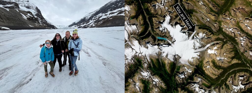
This is the Athabasca Glacier. It’s a slow moving river of ice 4 miles long and 300-980 feet thick, sliding off the larger Columbia Icefield in the Canadian Rockies. It looks big from a distance, and it feels even bigger when you’re walking across it on crampons and aren’t used to the altitude! The depth of the ice became apparent when we looked into a crevasse.
All of Iowa looked like this at some point during the last 2 million years, except the ice was even thicker. The Des Moines Lobe of the Wisconsinian ice sheet melted from northern and central Iowa just 12,000 years ago, leaving behind flat, marshy land. Other parts of Iowa have been ice-free for longer and had more time for wind and water to shape the hills and valleys.
2. Glacial Till
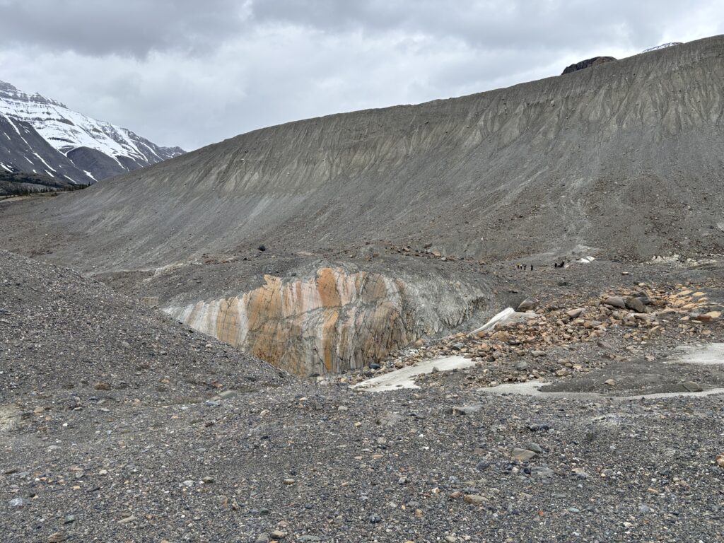
A sheet of ice hundreds of feet deep is heavy, and pushes against the earth with tremendous force as it slides slowly downhill. This photo shows both the scratches on the bedrock made by the glacier and the glacial till that it leaves behind–an unsorted mix of sand, silt, gravel, and boulders. You don’t have to travel to the Canadian Rockies to see Canadian rocks; during the ice age, the glaciers carried some all the way to Iowa!
Like a bulldozer, glaciers smooth out the ground underneath and leave a big pile of material at the edge when they stop. That’s why there’s a line of hills near Des Moines and a lot of flat land north of there. You can see a flat ground moraine in the foreground of this picture and a steep lateral moraine in the background.
3. Soil Formation
Despite the harsh conditions at the edge of the glacier, a few tiny flowers were blooming! This plant is a Saxifrage, “stone-breaker” in Latin. Plant roots and associated fungi speed up the process of breaking down rock and turning it into soil.
It’s still a slow process! It took thousands of years for prairie roots, microbes, and burrowing animals to turn lifeless glacial till into Iowa’s rich black topsoil, but only 160 years of tillage to lose half of it. Fortunately, there are ways to grow crops without degrading our soil. As Practical Farmers of Iowa puts it, “don’t farm naked!”
4. Continental Divide
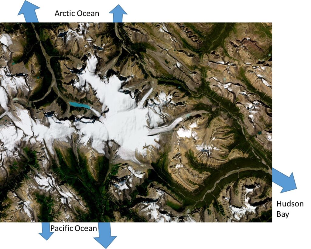
The Columbia Icefield sits at the junction of two continental divides. Meltwater from the Athabasca Glacier joins the Saskatchewan River, which ultimately makes its way to Hudson Bay. However, meltwater from the Stutfield Glacier on the other side of the mountain ends up in the Arctic Ocean, and meltwater from the Columbia Glacier goes to the Pacific Ocean.
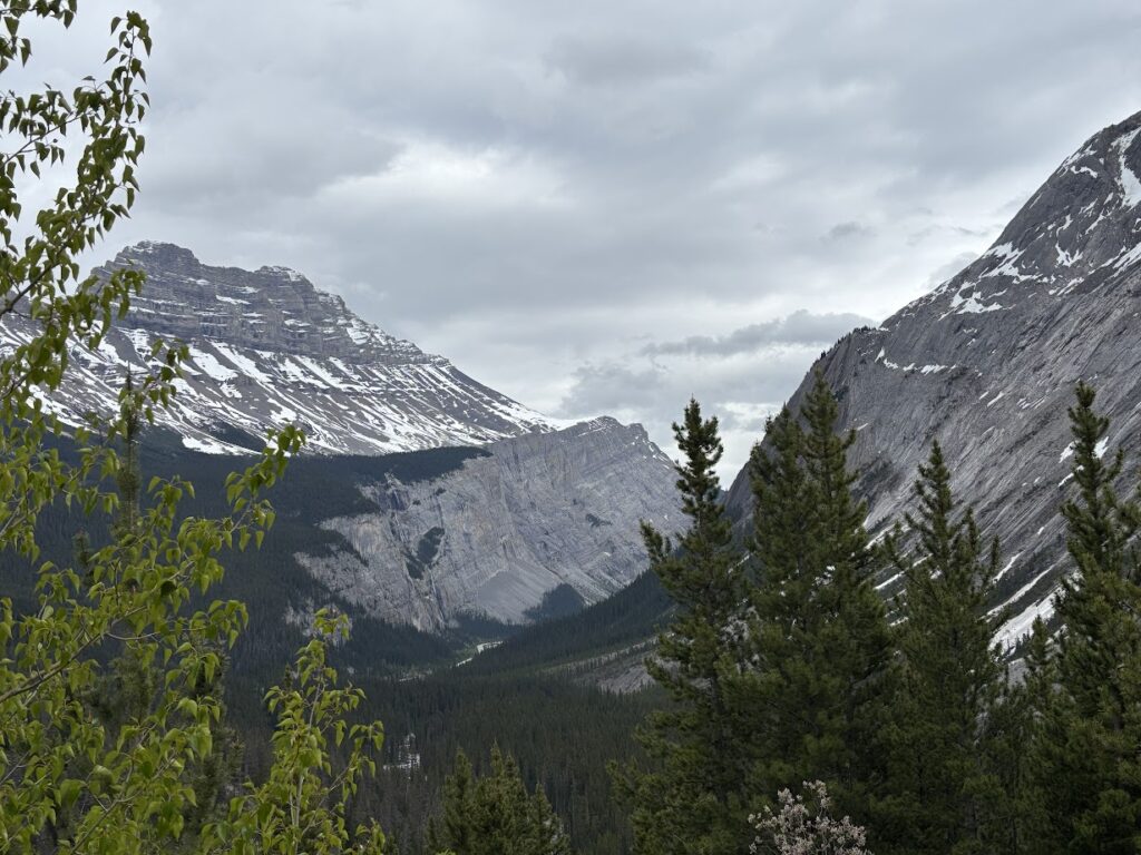
In the Canadian Rockies, the watershed boundaries are impossible to miss: lines of awe-inspiring mountain peaks on either side of a river valley. You might be driving along the Bow River until you reach it’s headwaters, and then you come to a mountain pass, your ears pop, and… ta da! You’re in a new watershed, following the Mistaya River downhill.
In Iowa, the dividing lines between land that drains to the Mississippi River and the Missouri River (or any other pair of rivers) are hard to find without a topographic map. We’ve put up watershed signs around Story County to make it more obvious.
Why does is matter what watershed you’re in? Well, knowing which land drains to which river can tell you something about the water quality in the river, and who to talk to if you want to improve it.
5. Meltwater
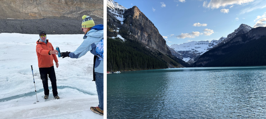
Our guide refilled our water bottles from a stream of glacial meltwater. I felt comfortable drinking it without boiling or filtration because nothing lives on a glacier. Elsewhere in the mountains, there’s a risk that wild animals living in or near the water might have left behind a little present containing a parasite like Giardia. Fecal contamination tends to get worse as you move downstream into areas with a lot of cows or a lot of people, and Alberta has its own set of water quality issues associated with mining and oil extraction. However, there’s a notable difference from Iowa: when natural resource agencies issue a beach advisory because of E. coli, it’s unusual enough to make the news!
The water from the glacier was refreshing but tasted a little… dusty. Like the taste in your mouth when you’re standing on a gravel road and truck passes by. Ames tap water is better!
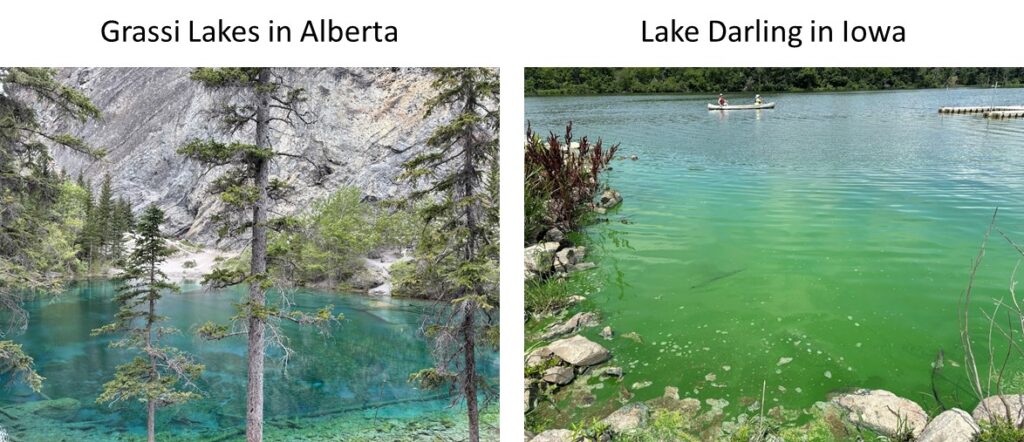
However, the glacial dust (rock flour) reflects the light, turning mountain lakes a lovely shade of blue, turquoise, or green. In Iowa, green or blue-green colored water is usually a sign of an algae bloom, unpleasant to swim in and possibly toxic!
6. Climate Change
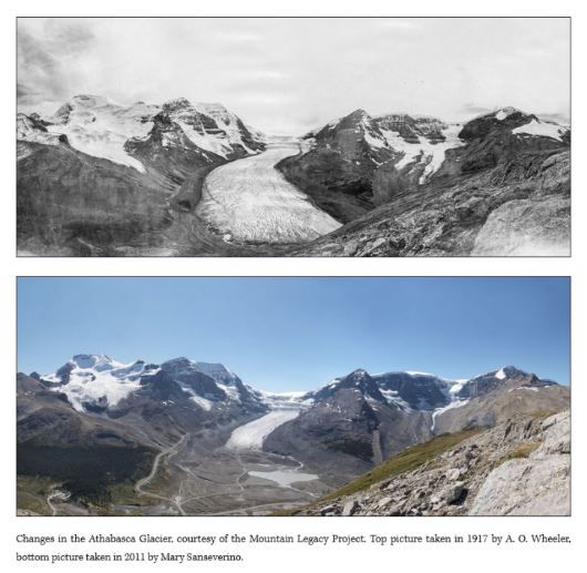
We made sure to include a visit to the glacier in our vacation plans because there may not be many more opportunities to see one. In a stable climate, a glacier would melt a bit in summer and grow back with winter snows. In a warming world, glaciers are melting rapidly.
Driving from the visitor center to the trailhead, we passed a series of ridges (terminal moraines) marked with dates. Since 1844, the ice has been receding and the pace of melting has accelerated in recent years. None of my pictures capture this, so I will screenshot an a pair of images from the Mountain Legacy Project and point you to Amy Snider for more art, maps, and photos about the Athabasca Glacier.
Climate change has been less noticeable in Iowa than in other parts of North America because of the moderating influence of corn sweat (evapotranspiration), but that won’t last. Rising temperatures, more intense spring rains, and greater weather variability are projected to lower yields and undermine what little progress we’ve made in addressing water quality. Alberta’s economy is dependent on fossil fuels, but Iowa has a lot of gain from a transition to green energy, and a lot to lose if we don’t make the switch.
7. Fossils
At the edge of the glacier, we saw a trilobite fossil in a 510-million year old rock, a relic of a time when erosion rates were even higher than they are now because there weren’t any plants yet. The broken shells, sand, and silt that covered the seafloor has since turned to rock and been pushed up to form new mountains.
The trilobites are long gone, wiped out during another episode of global warming and ocean acidification, this one triggered by massive volcanic eruptions 252 million years ago. It was the biggest mass extinction in Earth’s history, but after fifty million years or so, the land, seas and sky were teeming with new species.
If you take a long enough view, arable soil, clean water, and biodiversity are renewable resources. On human timescales, they’re definitely not. Agriculture and civilizations developed during a time of stable climate, and they may not last much longer if we don’t take more aggressive action to limit greenhouse gas emissions. The Earth will go on without us.
My Geology Summer Reading List
Landforms of Iowa, by Jean C. Prior
Timefulness by Marcia Bjornerud
Otherlands by Thomas Halliday




A marvelous essay with anecdotes and background facts. Well written and fun to read.