Four-lane Highway 30 finally connects Ames, Cedar Rapids by Jeff Morrison

Four-lane Highway 30 finally connects Ames, Cedar Rapids by Jeff Morrison

Hwy 30 road construction photo by Jeff Morrison

A vehicle passes a construction crew picking up traffic cones on eastbound U.S. Highway 30 near the Iowa Highway 21 exit north of Belle Plaine, Iowa, Tuesday, October 15, 2024. The segment of U.S. 30 between Iowa 21 and County Road V44 was the last in a nearly 150-mile-long span to open to four lanes. Photo by author.

Now that Thanksgiving, the traditional end to Iowa’s construction season, is here and gone, it’s time to reflect on a big highway milestone that passed with zero fanfare. In fact, its exact date could have gone unknown had the author not been driving to Des Moines at the right moment.

On Oct. 15, the final restrictions were lifted on U.S. Highway 30 in western Benton County. A 142-mile-long segment between Ogden and Lisbon is now an uninterrupted four-lane road. It’s been a long, long time coming — six decades, as a matter of fact.

Let’s switch off the lights and show an educational filmstrip.

The 16-minute movie from the Iowa State Highway Commission in 1960 was a key component in the state’s public relations strategy for a critical section of U.S. 30. From Ogden east to Iowa Highway 330, the rural highway had not been changed since original 18-foot-wide paving in the Lincoln Highway days. A concrete railroad overpass just east of Nevada dated back to 1923. (It would not be replaced until 1973. A narrow underpass a couple hundred yards away remains to this day.) While we now can appreciate the wide array of car makes and colors in the film, the volume of traffic was an important visual aid to pushing for an all-new road that skirted Ogden, Boone, Ames, Nevada, Colo, and State Center. At the time, the proposed relocation was mostly two lanes.

The campaign worked. By the end of 1964, an all-new road existed along the 55-mile corridor except, ironically, for the highest-traveled segment: Lincoln Way through most of Ames. This segment got bogged down in an argument among the Highway Commission, the city, and Iowa State University on whether, and where, to build an exit south of the university. At one point the plan for the U.S. 30 freeway did not include the single most important entry/exit point for Iowa State events. Although by 1966 the kernel of the idea of the Iowa State Center had been planted, Elwood Drive was “presently a gravel road” (Ames Tribune), Hilton Coliseum would not open for another five years, and the football stadium for another four years after that.

Hwy 30 Ogden to Lisbon
Iowa Highway Ends/Between Two Rivers

The Ames bypass would not be finished until nearly a decade after the rest of the new road had opened — fall 1972. Wrapping up the connection on the west end was prolonged after weather delays including the blizzard of April 8-10, 1973.

Through the turn of the century, only about a third of the 100 miles between I-35 and I-380 were upgraded, mostly south and west of Cedar Rapids.

A photograph of a page from a May 1968 plan shows a proposed four-lane U.S. Highway 30 in Benton County

A photograph of a page from a May 1968 plan shows a proposed four-lane U.S. Highway 30 in Benton County that, in the eastern half of the county, would have dipped half a mile south of the existing road. When U.S. 30 was upgraded to four lanes east of the U.S. Highway 218 junction in 1992 and 1999, it followed the existing road instead. To the west, in the segments that opened in 2024, the four-lane is just a few hundred feet south of the original.

The Highway Commission laid out a comprehensive plan in 1968 envisioning a full statewide network of freeways and expressways — and then the 1970s happened. A substantial percentage of the 1968 network would not be built until between 1994 and 2008 — and then the Great Recession happened.

Midway through that latter time span, a projected funding shortfall put U.S. 30 on the back burner. Other long-awaited corridors received priority instead.

If the state’s plan from 1999 had been carried out, the gap from Marshalltown to U.S. 218 would have been closed by 2005 and finished in eastern Linn County shortly thereafter. Instead, it took until 2024.

A very small ribbon-cutting ceremony was held for the U.S. Highway 30 Tama-Toledo bypass at the west end of that bypass August 13, 2011, in Toledo, Iowa. The four-lane road is the fourth alignment of the highway here since 1926. Photo by author.

A very small ribbon-cutting ceremony was held for the U.S. Highway 30 Tama-Toledo bypass at the west end of that bypass August 13, 2011, in Toledo, Iowa. The four-lane road is the fourth alignment of the highway here since 1926. Photo by author.

It’s been more than 10 years in coming, but the Iowa Department of Transportation has marked the beginning of the Highway 30 Mount Vernon/Lisbon bypass project. … Many project specifics — such as cost and the exact bypass route — won’t be determined for some time. Construction is at least five years away.
— Cedar Rapids Gazette, Aug. 27, 1999

The U.S. 30 bypass of Mount Vernon/Lisbon from west of Wilcox Road in Linn County to Charles Avenue in Cedar County will be open to traffic late Friday afternoon, Nov. 22, weather permitting … .
— Iowa DOT press release, Nov. 18, 2019

The "Bohemian Alps" of Iowa near Tama and Belle Plaine

Tama County’s “Bohemian Alps” before 4-land Hwy 30.  Photo by Prairie Rivers of Iowa

The final section had to cut through Tama County’s Bohemian Alps. These rolling hills are why the Lincoln Highway originally dipped southward to Belle Plaine. It made for a scenic drive whenever you weren’t trailing a semi, but that wasn’t often.

This segment of U.S. 30 has a relative rarity for Iowa travelers: 45 miles and no gas stations (or restrooms). The route had once been peppered with them, including the historic Youngville station, which was at risk of being demolished in the 1990s but has been preserved. Cedar Rapids Gazette columnist Dave Rasdal wrote about the lack of stops in 1994. The gas station at the Luzerne corner (County Road V44) closed a few years after a manager was shot and killed there. Today, for a fill-up visible from the highway, there’s nothing between Toledo and southwest Cedar Rapids. 

Youngville Station Before photo
Youngeville Station after restoration

Youngville Station when the Lincoln Highway/Highway 30 was the main east-west route across Iowa and after restoration and now accessed by exiting the 4-lane Highway 30 at Highway 218 west of Cedar Rapids.

The dream of a full four-lane U.S. 30 across Iowa refuses to die. In the last legislative session, there was a bill that took a non-nuanced approach to make the Iowa Transportation Commission “prioritize” the road and “expand all portions of the highway … until the entire length of the highway is made up of four-lane divided roadways.”

The new U.S. 30 can serve as a relief route for I-80 and provide a smooth ride from Cedar Rapids to Ames or Des Moines. The entire corridor provides drivers with a hassle-free trip…

…until the Iowa DOT puts at least one and maybe up to three roundabouts on the south side of Boone.

My other work can be found on my website, Iowa Highway Ends, and its blog.

–Jeff Morrison

Between Two Rivers


‘Big Boy’ visits Belle Plaine by Jeff Morrison

‘Big Boy’ visits Belle Plaine by Jeff Morrison

The Union Pacific’s No. 4014 “Big Boy” steam locomotive stops in downtown Belle Plaine, Iowa, on Thursday, September 5, 2024. The train’s trip across Iowa closely followed the Lincoln Highway. Photo by author.

BELLE PLAINE — Little boys love Big Boy. Big boys love Big Boy. On Thursday, hundreds of people turned out to see Big Boy.

“Big Boy” is the nickname of the 25 huge trains built in 1941 for the Union Pacific Railroad. The Omaha World-Herald introduced it as a “mastiff among puny terrier locomotives.” There are seven remaining in museums. That number used to be eight, but No. 4014 was pulled out of a California museum and restored in the 2010s. Five years after its initial excursion in 2019, the last Big Boy returned to Iowa as part of an eight-week, 10-state “Heartland of America Tour.”

John Sutherland, 75, of North Liberty was seeing Big Boy for the first time. “Railroading runs in my family’s blood. My grandfather worked for the Pullman-Standard Steel Car Co. and my great-grandfather was the line superintendent for the Michigan Central Railroad.” He’s not much of a train spotter, but the opportunity to see Big Boy was too good to pass up.

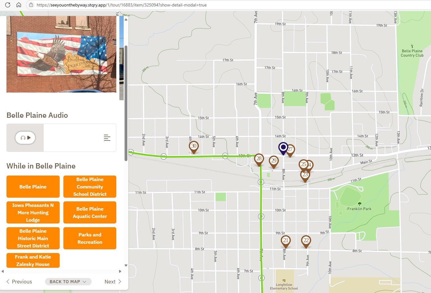
Belle Plaine, Iowa

The Iowa-Illinois portion of Big Boy’s 2024 trip followed trackage that was originally part of the Chicago & North Western Railroad and closely parallels U.S. Highway 30 and the Lincoln Highway. Its public stops were in Carroll, Belle Plaine and Grand Mound. Those stops doubled as service periods, since the world’s largest operating steam locomotive requires a high degree of maintenance.

George Kornstead of Iowa City was wearing a Hawkeye Model Railroad Club shirt. He grew up around the rail hub in Duluth and Superior. “Steam is incredible, it really is, to watch how back in the day when people were working on railroad, how hard it was and how intensive it was to keep steam available on the locomotive. Lot of work. The fireman really makes his money.”

Big Boy pulls into Belle Plaine with Lincoln Highway Mural in background

The World-Herald in 1941 said at the first Big Boy’s launch, “A single tender loading of coal would heat a six-room home for three years.” This Big Boy has been converted from using coal to using oil.

Steven Ritchie, 6, wore a “Big Boy” T-shirt. His father, Roger, said Steven has seen a lot of train videos and sings “the Big Boy song.” Andrew Schamberger of Hudson wore a C&NW T-shirt. His sister, Becca Scott of West Branch, loves the old steam engines.

According to the UP’s website, No. 4014 racked up a million miles of travel in its 20 years of original service in Wyoming and Utah. It’s nearly twice as long as a standard diesel locomotive and more than half the length of a Boeing 747 jet. The Big Boys “had a 4-8-8-4 wheel arrangement, which meant they had four wheels on the leading set of ‘pilot’ wheels which guided the engine, eight drivers, another set of eight drivers, and four wheels following which supported the rear of the locomotive,” the website says.

The Union Pacific’s “Big Boy” glistens during a light rain shower in downtown Belle Plaine, Iowa, on Thursday, September 5, 2024. Engine No. 4014 was built in 1941, decommissioned in 1961, and restored in time for the 150th anniversary of the transcontinental railroad in 2019. Photo by author.

Big Boy’s visit was a way to connect with railroad history. Paul Duffy, 85, is from “Tama, really,” but now lives nearer Belle Plaine. He worked for the C&NW and then with UP after the two railroads merged. He had been stationed at multiple points along the railroad in Iowa through his career. His oldest of five daughters, Laurie Duffy, remembers going to the station in Tama with her children to wave at Paul as his train went by.

As Big Boy finally pulled into Belle Plaine 55 minutes after its scheduled arrival, the only rain in a week’s worth of weather showed up with it. It did not dampen the spirits of those who waited, although busloads of elementary school students were only able to get a short glimpse of the train before leaving.

On the other track, a modern UP train with a long line of double-stacked shipping containers prepared to resume its trip west. Freight trains have been going through Belle Plaine for more than a century and a half, and Thursday was no exception.

After the wheels had been greased up and spectators got their fill of pictures, Big Boy’s engineer pulled the whistle and rang the bell. The 83-year-old engine began to chug its way toward Cedar Rapids for the night.

Roll on, Big Boy, roll on.

My other work can be found on my website, Iowa Highway Ends, and its blog.

I am proud to be part of the Iowa Writers’ Collaborative.

Jeff Morrison

Freedom Rock Tour and a Liberty Rock on the Lincoln Highway and the Iowa Valley Byways

Freedom Rock Tour and a Liberty Rock on the Lincoln Highway and the Iowa Valley Byways

Freedom Rock in Boone along the Lincoln Highway

Hello byway travelers!

I am writing today from the National Lincoln Highway Association’s Annual Conference in Elkhart, Indiana! Since I am here all week I thought that I would share with you the feature that I submitted for the Iowa Byways monthly newsletter. If you would like to learn more about Iowa’s other byways be sure to sign up for the newsletter at: https://iowadot.gov/iowasbyways

It seems fitting that as we get ready to celebrate America’s Independence Day that we should celebrate the Lincoln Highway Heritage Byway. The Iowa byway gained National Scenic Byway status in 2021 for the historical significance to our country as the first planned transcontinental highway across the United States.

On July 1, 1913 Carl Fisher’s coast-to-coast rock highway was officially named the Lincoln Highway after the 16th President of the United  States, Abraham Lincoln. The Lincoln Highway Association was officially incorporated and tasked with promoting the Lincoln Highway to local governments and the public. It was no coincidence that Lincoln, a martyr for freedom, was chosen by Henry Joy (the association’s first president) to represent the roadway. Lincoln was a martyr of freedom and the idea of having an improved road across the country that anyone could use to move about freely was the goal. The road soon became known as the “Main Street Across America” and an avenue to a new life for many. 
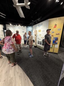
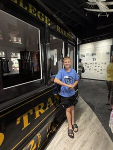
The Lincoln Highway has another significant date in July and that is July 7, 1919 when the first of its kind Transcontinental Motor Convoy left Washington DC to meet up with the Lincoln Highway in Gettysburg and traverse the route. There were 81 military vehicles, 37 officers, and 258 enlisted men who began the trip. Not all of them made it the distance. The Convoy traveled through a muddy Iowa from July 22- July 28th. Read more on the Transcontinental Motor Convoy

Many of the 43 communities across Iowa’s Lincoln Highway choose the fourth of July as their community’s annual town celebration. Belle Plaine has held a July 4th celebration for many years and good ol’ George Preston would even pull his two-headed pig in the parade. Mount Vernon’s Lincoln Highway Nitty Gritty has about the best name out there and highlights history through antique displays and shopping in the streets and local businesses. The larger towns of Clinton, Council Bluffs (at the historic General Dodge House), and Ames have annual celebrations as do some of the smaller towns like Logan. But the town that wants to really own the fourth of July is Marshalltown, the location of Iowa’s Veteran’s Home which also happens to be one of the largest Veteran’s Homes in the country. 

All this talk of freedom and veterans brings us to the topic of this month’s newsletter, Iowa’s Freedom Rocks. The first Iowa Freedom Rock was painted in Adair County in 1999. Artist, Ray “Bubba” Sorensen II wanted to give veterans unique recognition on Memorial Day.  Eventually Bubba began a Freedom Rock Tour, where his goal was to paint a Freedom Rock in every county honoring the history and veterans who had connections to the county. Bubba has even started a 50 State Freedom Rock Tour. There is now a Freedom Rock in every one of Iowa’s 99 counties, a 100th one in Altoona, and a Liberty Rock in the Lincoln Highway community of Glidden.  Read more about this special rock, Freedom Rocks along the byways and other byway events in the July newsletter!

Safe Travels!

Iowa’s Scenic Byway Coordinators

Greene County Freedom Rock
Carroll County Freedom Rock
Boone County Freedom Rock

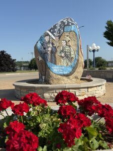
The Lincoln Highway Heritage Byway traverses through 13 Iowa counties.  Of those 13 counties, five of the communities are home to their counties’ Freedom Rock but there is another rock that is on the Lincoln Highway that is not a Freedom Rock. It is the Glidden Liberty Rock. The Carroll County Freedom Rock was complete when the community of Glidden approached Bubba wanting their own rock. The fact that Glidden has ties to the beginning of WWI and the end of WWII inspired the artist to say yes. The Glidden Liberty Rock portrays Merle Hay, the first Iowan and one of the first three Americans killed in WWI, the “Enola Gay” plane that dropped the bomb to end WWII, injured veteran Ralph Neppel, and a Vietnam Vet Donald Sparks, MIA.

Liberty Rock in Glidden on the Lincoln Highway
Glidden Liberty Rock

The Lincoln Highway Freedom Rock Tour also includes: Clinton County (Clinton), Cedar CountyLinn County (the 99th rock completed), Benton County, Tama County (features Meskwaki Code Talkers), Marshall County (Marshalltown), Story County, Boone County (Boone) , Greene County (Jefferson), Crawford County , Harrison County (Lincoln Highway/Loess Hills Interpretive Center), and Pottawattamie County (Lewis & Clark Trail).


Story County Freedom Rock
Tama County Freedom Rock
Tama County Freedom Rock from road
Linn County Freedom Rock

Located in the Gateway Park & Preserve in Marengo, the Iowa County Freedom Rock is protected beneath a lighted pavilion.  One side of the rock features Marengo born Marine Sgt. Major Bradley Kasal. Kasal was awarded the Navy Cross for his heroic action during a firefight in which he was severely injured during Operation Phantom Fury in the Gulf War. Williamsburg native, Eugene Ely, an aviation pioneer who was credited with the first shipboard aircraft take-off and landing is featured beneath the American flag. Army Air Force veteran Dr Burns Byram is also featured on the rock. Byram would fly his restored military plane, “Tangerine” low over the town of Marengo to announce that the doctor had arrived. Other Iowa Valley Scenic Byway counties include the Benton County Freedom Rock which features Army, Navy, and Air Corps heroes and the Tama County Freedom Rock which features the Meskwaki Code Talkers.

Benton County Freedom Rock
Cedar County Freedom Rock
Clinton County Freedom Rock

I hope you have enjoyed this Lincoln Highway and Iowa Valley Freedom Rock Tour. Have a wonderful July and I will see you on the byway!!

Where Was I on the byway? Part 1

Where Was I on the byway? Part 1

Where Was I Hot beef sandwich

“Where Was I on they byway?” began as a post on our Facebook page that was telling people, “Hey look what famous Lincoln Highway Café is open again!” Since I began work as the byway coordinator for the Lincoln Highway Heritage Byway, there was speculation as to whether or not the beloved Cronk’s Café in Denison was gone forever or if the new owners would save the tradition. I had seen the Cronk’s sign lit up on a previous trip, but the restaurant wasn’t open. On this trip it was open and what better way to announce to our followers than with a good old fashioned hot beef sandwich with mashed potatoes and gravy (or pork in this case)? The post was very popular, most people knew where I was and they were just as excited as I was that Cronk’s would live on in the form of Cronk’s Café American and Mexican Restaurant.

.

Cronk's Cafe postcard
cronks cafe
cronks party room
cronk's cafe sign
American and Mexican
Cronks inside
Wheatland Calamus bridge

This Facebook post of the bridge and asking, “Where am I on the byway,” was an impulsive live post as I was doing sign inventory on the byway. Bridges on the byway are so beautiful in whatever form or shape they are in, and people love them!  Everyone knew that I was at the Wapsi Bridges between Calamus and Wheatland.  I learned from followers that the bridges had been closed since the 1990s and that there were holes in the steel underneath that were big enough for a person to get through.  The bridges here are actually a series of three bridges. Funding is secured for the replacement of the middle bridge (with a wider decking) and the county is currently seeking funding for the western-most bridge.  A Pony Truss bridge is at the eastern side of the section of roadway and will not be restored as a roadway. It will be wonderful to open this stretch of the Lincoln Highway Heritage Byway to drivers again! I also learned that there was an amusement park here!!

Wheatland Calamus bridge over Wapsi River
wheatland calamus bridge Wapsi River
Pony-tress bridge over the wheatland calamus bridge
Where Was I on the byway?


Where was I on the byway that I saw this guy?

I had gotten a kick out of this guy when I toured this museum. Our friend had his dental work (yes, real teeth) done in a historical dentist chair at one of the many buildings on site. A 1928 Lincoln Highway marker is at its original location here tucked near a lilac shrub. There are many buildings to check out from the 1800s, hiking trails, a video presentation, a gift shop, and a weekly farmer’s market from May to October. The highlight is at the top of the hill where you can stand on the ridge by the Lincoln Highway metal railing and take a selfie viewing the Lewis and Clark Trail, the Western Skies Scenic Byway, the Loess Hills National Scenic Byway and the Lincoln Highway Heritage Byway!

So where was I?                                       

I was at the Harrison County Iowa Welcome Center and Historical Museum!

Harrison County Iowa Welcome Center
Harrison county welcome center museum display
Welcome Center gas station picnic area
Harrison County Welcome Center Lincoln Highway bridge model
Welcome Center Selfie Station on Lincoln Highway Heritage Byway National Scenic Byway
Where was I on the byway?

This post was the first regular Wednesday, “Where Was I on the byway?” Alas, our followers did know exactly where I was!! : Answer to yesterday’s “Where Was I on the byway?” is atop the hill ridge between Ogden and Boone in the Des Moines River Valley. Seven Oaks Recreation – Boone IA is located on the same ridge about a 1/2 mile south on Hwy 30.  (photo credit of Seven Oaks goes to Jeff Robak posting in I grew up in Iowa!). 

Seven Oaks
Where was I on the byway?

This post was one of my favorites although highly controversial in the Lincoln Highway world. I thought it was incredibly interesting and educational and hopefully I opened some minds.

Here is the post:  I am always checking the Lincoln Highway Association map to see where any concrete Lincoln Highway markers are. I had to do some searching to find these two, but I found them! Where was I? 
The comments were of surprise (the surprise emoji) and shock and I quickly learned why. I will answer the “Where Was I?” first. 


Wednesday’s Where Was I on the byway? …was Carlyle Memorials in Denison, IA.

The three original concrete Lincoln Highway markers lay on the ground on the west side of the building and according to the National Lincoln Highway Association map, at one time served as a wheel block for parking. This unique use for the damaged markers does allow for a good study in how they were constructed. You can see that the colors were all created separately and laid in the posts.  This also shows us that the color is IN the concrete.  If you have an original marker on your property, do not use paint to touch it up.  A good power-wash is all that is needed to refresh it!  
I also learned from followers that the 1913 cornerstone was from the St. Rose of Lima Catholic Church/School from Denison. Carlyle Memorials is storing it for them as they have often done for other Denison residents. 


Wanted Lincoln Highway markers

I may be frowned upon by some in the Lincoln Highway Association for my opinion, but I say to, “Value what you have as you have it.”  In 1928 there were 2,436 markers installed by the Boy Scouts at approximately 1 mile apart. As time continues to pass many of the markers have been lost and rarely can you find one in the original location. The markers at Carlyle Memorials could have ended up buried in the ground on a farmer’s land somewhere or (more likely) in a DOT’s dumpsite. They aren’t missing. They are right there for you to discover (with the owner’s permission) where you can see how they were made to last 104 years along a highway.  I would like to add that the owners are 3rd generation small business owners and completely respect and honor their history and the history of the Lincoln Highway.  
 

 With that, I will end this blogpost. I am enjoying the “Where Was I on the byway?” postings and learning from you, the readers. I hope to give you a fairly accurate count of how many 1928 markers that Iowa still has in the coming year (it is over 30). Keep following me and I will see you on the byway!

Where Was I on the Byway sign over the Iowa Byways Lincoln Highway Heritage Byway logo

Lincoln Highway – A Poem by Amelia Kibbie

Lincoln Highway – A Poem by Amelia Kibbie

Hover then click the arrows to move from one verse to the next (best seen on desktop).

Lincoln Highway

by Amelia Kibbie

It’s hard to imagine now

as our modern mobiles whisper past

that along this road

horses and herds of cattle passed

and the air was splattered

with the jangled rattle of Model A’s and T’s

the clattered patter of Tin Lizzies.

New York, New York

1914 Times Square

This city, our homegrown gotham

the gateway to America

and the road started there or ended — beginnings and endings

are muddled, as is our mixed memory
and truth-stained history.

Named for Lincoln

who put pen to paper and called for freedom

freedom, the siren song of the automobile

“Life is a Highway”

“Every Day is a Winding Road”

“Bacon and eggs to fix…”

Never mind that the children of those he freed

had to use the Green Book to

keep them safe as they traversed this path

and many others.

Was that freedom?

Nostalgia is not memory

but from sea to shining sea,

follow the hood ornament

until you’ve reached the terminus

the Golden Gate, so named

by a pathfinder-colonizer

All that’s left is the open ocean.

Think of this place

where we stand

as a bead strung on a necklace

that adorns the decolletage of our country

some jewels bigger or more intricate than others

but hanging on the same chain

and just as precious.

Traveled to this day,

the roads were the pride of ancient Rome

a piece of history, yes

but to us

this road leads home.

About the author :

Amelia Kibbie is an author, poet, and lifelong educator. Her debut novel Legendary was published in 2019 by Running Wild Press. Amelia’s short stories have appeared in several anthologies, including the pro-human sci-fi collection Humans Wanted, We Cryptids, Enter the Rebirth, and My American Nightmare: Women in Horror. The literary journals Saw Palm, Quantum Fairy Tales, Wizards in Space, and Intellectual Refuge have featured her work. Her next project is to renovate the turn-of-the-century church she just purchased into a home with the help of her husband, daughter, and four cats. She served on the Lisbon Historic Preservation Commission and as Mt. Vernon/Lisbon Poet Laureate in 2020. Her most recent publication is a book of poems paired with and inspired by the photography of Robert Campagna, a local photographer who was once her teacher. Final Elegance is available by special order — email ameliamk1983@gmail.com for details or visit ameliakibbie.com.

Amelia Kibbie