Lincoln Highway National Heritage Byway Complete Sign Inventory Begins
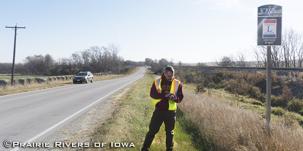
On a recent beautiful crisp fall morning, Prairie Rivers of Iowa staff and a volunteer set out to travel the Lincoln Highway National Heritage Byway through urban streets and gravel roads in Story and Boone counties. Byway Coordinator Jonathan Sherwood is starting a new project across all thirteen counties and 43 municipalities to inventory and assess the condition of the Byway’s signage. These signs are a critical part byway infrastructure and have historical significance as an evolution of what came before.
From the beginning of the Lincoln Highway, tools were needed to assist the traveler including guidebooks and signs along the route. In the early era of the established transcontinental route, signs were painted on telephone poles ad hoc by local councils and volunteers.
Today travelers along the historic route in Iowa rely on guidebooks, maps, and signage. These aids are thanks to the efforts of many individuals, organizations such as Prairie Rivers, and government agencies like the Iowa Department of Transportation (IDOT).


Over time all the byway signs need to be maintained. The condition of the signs has ranged from excellent to vandalized, bent, and faded from the sun. Some signs are missing from their original location. The signs are always located at any turn with directional arrows. They are also located after any turn in the route where another sign confirms that the traveler is on the right path.
The inventory aims to improve the quality of the signage out on the roadway network, improve the life cycle of each sign from ordering, fabricating, installing, maintaining, and removing, improve the ability to budget for these key assets on a statewide basis, provide a tool for the decision maker to do signage related scenario planning.
The Iowa DOT has developed a geospatial program to maintain and update data on locations and conditions of signs statewide. Prairie Rivers’ staff are using iPads with ESRI’s ArcGIS Field Maps app loaded with IDOT data to wholly complete the survey. Previously condition reports were recorded based on individual needs, at specific times, in different districts or regions.
According to PRI staff, “This is a great way to see the byway while traveling down gravel roads at 25 mph, much like the original traveler in their Ford Model T.”
The project is expected to run through the fall and wrap up before road conditions deteriorate.


